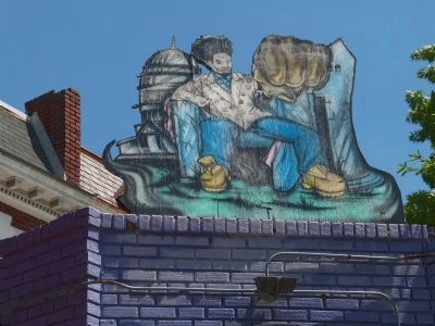
Park View in Northwest Washington in Washington, District of Columbia — The American Northeast (Mid-Atlantic)
The Next Wave
Lift Every Voice
— Georgia Ave./Pleasant Plains Heritage Trail —
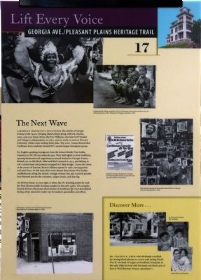
Caribbean immigrants discovered this stretch of Georgia Avenue in the 1940s, bringing island culture along with jerk chicken, curry, and coco bread. Many, like Eric Williams, who later led Trinidad and Tobago to independence in 1962, came to study or teach at Howard University. Others came seeking better jobs. the 2000 Census showed that Caribbean-born residents formed DC's second-largest immigrant group.
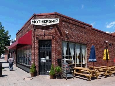
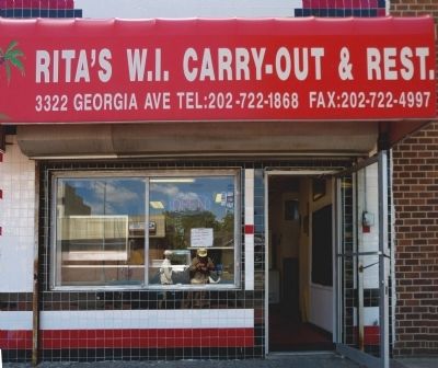
For English-speaking immigrants from the former British West Indies, transition to DC life was relatively easy. They held tightly to their traditions, opening businesses and organizing an annual festival on Georgia Avenue. Behind you on this block Mike and Rita's opened in 1974, specializing in roti, (curried meat and potatoes wrapped in flaky dough). Across the street, at the corner of Lamont, Brown's Bakery opened in 1980, serving patties and spice buns. At that time, there were almost three dozen West Indian establishments along this stretch. Georgia Avenue Day and Carnival parades have featured spectacular costumes, calypso music, and dancing.
On Morton Street, to your right, is where the DC Housing Authority built the Park-Morton public housing complex in the early 1960s. The complex housed African Americans whose homes in Southwest DC were demolished during urban renewal to make way for modern apartments and offices.
Erected by Cultural Tourism DC. (Marker Number 17.)
Topics and series. This historical marker is listed in these topic lists: African Americans • Immigration • Science & Medicine. In addition, it is included in the Georgia Avenue / Pleasant Plains Heritage Trail, and the Historically Black Colleges and Universities series lists. A significant historical year for this entry is 1962.
Location. 38° 55.917′ N, 77° 1.425′ W. Marker is in Northwest Washington in Washington, District of Columbia. It is in Park View. Marker is at the intersection of Georgia Avenue Northwest (U.S. 29) and Morton Street Northwest, on the right when traveling south on Georgia Avenue Northwest. Marker is on the southwest corner of Georgia Avenue Northwest and Morton Street Northwest. Touch for map. Marker is at or near this postal address: 3332 Georgia Avenue Northwest, Washington DC 20010, United States of America. Touch for directions.
Other nearby markers. At least 8 other markers are within walking distance of this marker. The Modern Shopper (about 400 feet away, measured in a direct line); Charles R. Drew and Lenore Robbins Drew (approx. 0.2 miles away); Park Road Community Church (approx. 0.2 miles away); Nob Hill (approx. ¼ mile away); A Changing Landscape (approx. ¼ mile away); The Former Engine Co 24 of the District of Columbia Fire Department
(approx. 0.3 miles away); District Walls, 2016 (approx. 0.3 miles away); "Treat Me Refined" (approx. 0.3 miles away). Touch for a list and map of all markers in Northwest Washington.
Photographed By Allen C. Browne, May 25, 2013
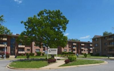
4. Park Morton Apartments
"Park Morton, constructed in 1960, is a walkup apartment community servicing families. It has 174 two-bedroom units. It has an on-site playground and is conveniently located near the Georgia Avenue shopping corridor." -- DC Housing Authority.
Credits. This page was last revised on November 3, 2023. It was originally submitted on July 8, 2013, by Allen C. Browne of Silver Spring, Maryland. This page has been viewed 592 times since then and 23 times this year. Last updated on March 7, 2019, by Devry Becker Jones of Washington, District of Columbia. Photos: 1, 2, 3, 4, 5, 6. submitted on July 8, 2013, by Allen C. Browne of Silver Spring, Maryland. • Bill Pfingsten was the editor who published this page.
Editor’s want-list for this marker. Photo of marker reverse. • A wide shot of the marker in context. • Can you help?
