West Harrison in Dearborn County, Indiana — The American Midwest (Great Lakes)
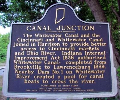
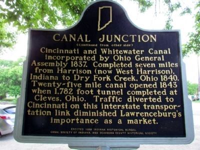
Canal Junction
(Front Side)
The Whitewater Canal and the Cincinnati and Whitewater Canal joined in Harrison to provide better access to Cincinnati markets and Ohio River. Indiana Internal Improvement Act 1836 authorized Whitewater Canal; completed from Brookville to Lawrenceburg 1839. Nearby Dam No. 1 on Whitewater River created a pool for canal boats to cross the river.
(Back Side)
Cincinnati and Whitewater Canal incorporated by Ohio General Assembly 1837. Completed seven miles from Harrison (now West Harrison), Indiana to Dry Fork Creek, Ohio 1840. Twenty-five mile canal opened 1843 when 1, 782 foot tunnel completed at Cleves, Ohio. Traffic diverted to Cincinnati on this interstate transportation link diminished Lawrenceburg's importance as a market.
Erected 1999 by Indiana Historical Bureau, Canal Society of Indiana, and Dearborn County Historical Society. (Marker Number 15.1999.1.)
Topics and series. This historical marker is listed in this topic list: Waterways & Vessels. In addition, it is included in the Indiana Historical Bureau Markers series list. A significant historical year for this entry is 1836.
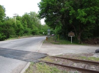
Location. 39° 15.072′ N, 84° 49.211′ W. Marker is in West Harrison, Indiana, in Dearborn County. Marker is at the intersection of S. State Street and Campbell Road, on the right when traveling south on S. State Street. Touch for map. Marker is in this post office area: West Harrison IN 47060, United States of America. Touch for directions.
Other nearby markers. At least 8 other markers are within walking distance of this marker. Morgan's Raiders Enter Ohio (approx. 0.2 miles away); When the Civil War Came to Indiana (approx. 0.4 miles away); Morgan's Great Raid (approx. 0.4 miles away); High Water Mark (approx. ¾ mile away); General John Morgan (approx. ¾ mile away); Harrison (approx. ¾ mile away in Ohio); P.F.C. William B. Baugh, U.S.M.C. (approx. ¾ mile away in Ohio); Harrison War Memorial (approx. ¾ mile away in Ohio). Touch for a list and map of all markers in West Harrison.
Credits. This page was last revised on June 16, 2016. It was originally submitted on July 20, 2013, by Duane Hall of Abilene, Texas. This page has been viewed 707 times since then and 29 times this year. Photos: 1, 2, 3. submitted on July 20, 2013, by Duane Hall of Abilene, Texas. • Bill Pfingsten was the editor who published this page.


