Franklin in Williamson County, Tennessee — The American South (East South Central)
Attack on the Union Left
Into a Withering Fire
— Hood's Campaign —
In September 1864, after Union Gen. William T. Sherman defeated Confederate Gen. John Bell Hood at Atlanta, Hood led the Army of Tennessee northwest against Sherman’s supply lines. Rather than contest Sherman’s “March to the Sea,” Hood moved north into Tennessee. Gen. John M. Schofield, detached from Sherman’s army, delayed Hood at Columbia and Spring Hill before falling back to Franklin. The bloodbath here on November 30 crippled the Confederates, but they followed Schofield to the outskirts of Nashville and Union Gen. George H. Thomas’s strong defenses. Hood’s campaign ended when Thomas crushed his army on December 15-16.
(main text)
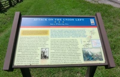
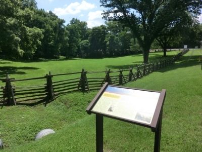
On the afternoon of November 30, 1864, elements of Confederate Gen. William W. Loring’s division rushed across the ground in front of you during the Battle of Franklin to attack the Federal left flank here. Union artillery fire from here and from Fort Granger to your right across the river raked Loring’s men as they approached, and the obstacle of the Harpeth River forced them to shift across the railroad. Jammed together in overlapping ranks, the Confederates suffered enormous losses.
Earlier in the day, as Federal troops constructed earthworks near the railroad tracks, they cut down several acres of Osage orange hedges and spread the thorny branches out in front of the works here. Loring’s men, trying to hack their way through, faced sheets of musketry and a deafening chorus of artillery fire from your right in the deepening twilight. Men fell in piles, dead or wounded. Some of them crawled on the hands and knees along the tracks, desperately looking for a way around the Union left flank. The Federals moved two artillery pieces to the edge of the railroad cut and fired point blank into the hapless Confederates.
The Union troops here—mostly Indiana men—inflicted enormous casualties on Loring’s division. Loring’s losses totaled almost a thousand, including two brigade commanders. Many of the Mississippi, Alabama, and Louisiana men who died here were buried along the road and tracks, and in front of the breastworks. A year and half later, they were reburied a mile from here at Carnton in the McGavock Confederate Cemetery.
"Oh! What a real comfort it was to know that we who, during the hot Summer (Atlanta) campaign, had stood the crash of so many fierce assaults against their solid fortifications, were now on the right side of the works, and in such a splendid position, with a gentle slope away from us and not even a mullein-stalk to obstruct our fire for a good third of a mile." — Union Capt. Eli T. Scofield
(captions)
(left) Gen. William W. Loring - Courtesy Williamson County Historical Society
(right) Kurz and Allison, Battle of Franklin
Erected by Tennessee Civil War Trails.
Topics. This historical marker is listed in this topic list: War, US Civil. A significant historical month for this entry is September 1864.
Location. 35° 54.885′ N, 86° 51.988′ W. Marker is in Franklin, Tennessee, in Williamson County. Marker is at the intersection of Lewisburg Avenue (U.S. 431) and Thompson Alley, on the right when traveling south on Lewisburg Avenue. Touch for map. Marker is in this post office area: Franklin TN 37064, United States of America. Touch for directions.
Other nearby markers. At least 8 other markers are within walking distance of this marker. Attack On The Union Left / Lot No. 1 in the Plan of Carnton (here, next to this marker); Mills - Jewell House (approx. 0.2 miles away); Dr. James A. & Eliza B. North House (approx. 0.2 miles away); 209 Lewisburg Avenue (approx. 0.2 miles away); The Carrick North House (approx. 0.2 miles away); Willow Plunge (approx. 0.2 miles away); 204 Lewisburg Avenue (approx. 0.2 miles away); The Carter Farm (approx. 0.3 miles away). Touch for a list and map of all markers in Franklin.
Credits. This page was last revised on June 16, 2016. It was originally submitted on December 8, 2013, by Don Morfe of Baltimore, Maryland. This page has been viewed 704 times since then and 13 times this year. Photos: 1, 2. submitted on December 8, 2013, by Don Morfe of Baltimore, Maryland. • Bernard Fisher was the editor who published this page.

