Clyo in Effingham County, Georgia — The American South (South Atlantic)
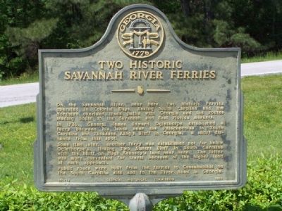
Two Historic Savannah River Ferries
In 1739, General James Edward Oglethorpe established a ferry between his lands near the Palachocolas in South Carolina and Tuckasee King's Bluff in Georgia, a short distance from this spot. Some time later, another ferry was established nor far below Oglethorpe's, linking Two Sisters Bluff in South Carolina with the bluff on Hugh Kennedy's land near here. The latter was more convenient for travel because of the higher land at each approach.
Public roads were built from the ferries to Coosahatchie on the South Carolina side and to the River Road in Georgia.
Erected 1958 by Georgia Historical Commission. (Marker Number 051-13.)
Topics and series. This historical marker is listed in these topic lists: Colonial Era • Settlements & Settlers • Waterways & Vessels. In addition, it is included in the Georgia Historical Society series list. A significant historical year for this entry is 1739.
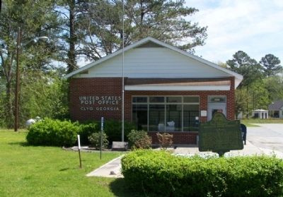
Location. 32° 29.003′ N, 81° 16.098′ W. Marker is in Clyo, Georgia, in Effingham County. Marker is at the intersection of Railroad Avenue (State Highway 119) and Williams Avenue, on the right when traveling north on Railroad Avenue. Located at the town post office. Touch for map. Marker is in this post office area: Clyo GA 31303, United States of America. Touch for directions.
Other nearby markers. At least 8 other markers are within 8 miles of this marker, measured as the crow flies. John Adam Treutlen (approx. 0.3 miles away); Early Baptists At Tuckasee King (approx. 3 miles away); Old Mount Pleasant (approx. 4.9 miles away); J. Lamar Brantley Road (approx. 5.2 miles away in South Carolina); Bethany (approx. 5.4 miles away); Effingham County (approx. 8 miles away); Confederate Memorial (approx. 8.1 miles away); Effingham County Veterans Memorial (approx. 8.1 miles away). Touch for a list and map of all markers in Clyo.
Credits. This page was last revised on June 14, 2020. It was originally submitted on April 18, 2008, by Mike Stroud of Bluffton, South Carolina. This page has been viewed 2,641 times since then and 57 times this year. Photos: 1, 2, 3, 4. submitted on April 18, 2008, by Mike Stroud of Bluffton, South Carolina. • Craig Swain was the editor who published this page.


