Near Goleta in Santa Barbara County, California — The American West (Pacific Coastal)
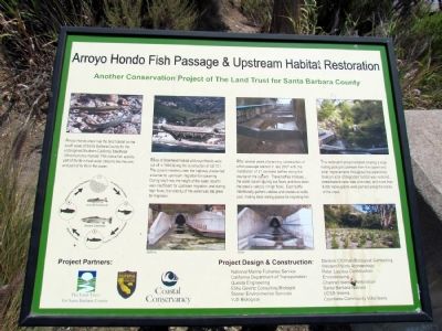
Arroyo Hondo Fish Passage & Upstream Habitat Restoration
Another Conservation Project of The Land Trust of Santa Barbara County
Inscription.
Arroyo Hondo creek has the best habitat on the south coast of Santa Barbara County for the endangered Southern California Steelhead (Oncorhynchus mykiss). This native fish spends part of its life in freshwater streams like this one, and part of its life in the ocean.
Miles of Steelhead habitat at Arroyo Hondo were cut off in 1949 during the construction of US 101. The culvert installed under the highway presented a barrier to upstream migration for spawning. During low flows, the height of the water column was insufficient for upstream migration, and during high flows, the velocity of the water too great for migration.
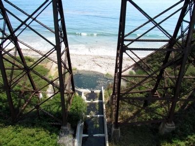
After several years of planning, construction of a fish passage started in late 2007 with the installation of 31 concrete baffles along the course of the culvert. These baffles increase the water column during low flows, and slow the creek’s velocity in high flows. Each baffle intentionally gathers cobbles and creates an eddy pool, making ideal resting places for migrating fish.
This restoration project entailed creating a large resting pool just upstream from the culvert and other improvements throughout the watershed. Over an acre of degraded habitat was restored, streamside erosion was controlled, and more than 8,000 native plants were planted along the banks of the creek.
Erected by The Land Trust for Santa Barbara County, California Department of Fish and Game, and the Coastal Conservancy.
Topics. This historical marker is listed in these topic lists: Animals • Environment • Roads & Vehicles.
Location. 34° 28.441′ N, 120° 8.405′ W. Marker is near Goleta, California, in Santa Barbara County. Marker can be reached from U.S. 101, 3½ miles east of Mariposa Reina. Marker is located at a scenic pullout on US 101 eastbound lanes approximately 3.5 miles east of Exit 128 (Mariposa Reina). Marker can only be accessed from the eastbound lanes of the freeway. Touch for map. Marker is in this post office area: Goleta CA 93117, United States of America. Touch for directions.
Other nearby markers. At least 7 other markers are within 14 miles of this marker, measured as the crow flies. Gaviota Pass (approx. 5.1 miles away); The Past and Future Las Cruces Adobe (approx. 5.6 miles away); Las Cruces • The Crosses (approx. 5.6 miles away); Mission Santa Inéz (approx. 8.4 miles away); Bit O' Denmark (approx. 8.4 miles away); Los Olivos 1887 (approx. 13.3 miles away); Rancho De Los Olivos Farmhouse (approx. 13.3 miles away).
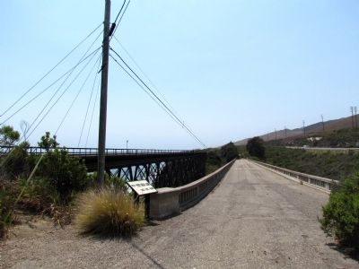
More about this marker. Marker may be reached by a short walk from the western end of the scenic pullout along the old US 101 roadbed.
Also see . . .
Arroyo Hondo Preserve. From The Land Trust for Santa Barbara County website. (Submitted on February 23, 2014.)
Credits. This page was last revised on June 16, 2016. It was originally submitted on February 23, 2014, by Duane Hall of Abilene, Texas. This page has been viewed 686 times since then and 30 times this year. Photos: 1, 2, 3. submitted on February 23, 2014, by Duane Hall of Abilene, Texas.


