Columbus in Colorado County, Texas — The American South (West South Central)
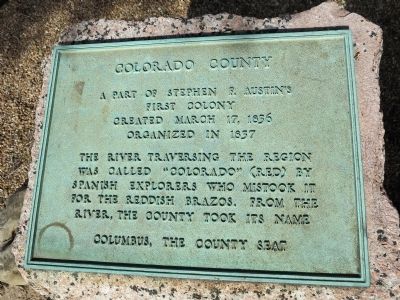
Colorado County
First Colony
Created March 17, 1836
Organized in 1837
The river traversing the region was called “Colorado” (red) by Spanish explorers who mistook it for the reddish Brazos. From the river, the county took its name
Columbus, the county seat
Erected 1936 by Texas Highway Department. (Marker Number 973.)
Topics and series. This historical marker is listed in these topic lists: Hispanic Americans • Settlements & Settlers • Waterways & Vessels. In addition, it is included in the Texas 1936 Centennial Markers and Monuments series list. A significant historical date for this entry is March 17, 1861.
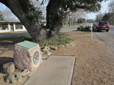
Location. 29° 43.163′ N, 96° 33.133′ W. Marker is in Columbus, Texas, in Colorado County. Marker is on Business State Highway 71 near Farm to Market Road 109, on the right when traveling west. Located ½ mile north of the Colorado River. Touch for map. Marker is in this post office area: Columbus TX 78934, United States of America. Touch for directions.
Other nearby markers. At least 8 other markers are within walking distance of this marker. Robson's Castle and Columbus, Texas, Meat and Ice Company (approx. 0.6 miles away); George Glenn (approx. 0.6 miles away); The Isgrig House (approx. 0.8 miles away); Dick-Gillette House (approx. 0.9 miles away); Keith-Traylor House (approx. 0.9 miles away); Youens-Hopkins House (approx. 0.9 miles away); Columbus Oak (approx. 0.9 miles away); Simpson - Williamson House (approx. 0.9 miles away). Touch for a list and map of all markers in Columbus.
Credits. This page was last revised on June 16, 2016. It was originally submitted on February 26, 2014, by Richard Denney of Austin, Texas. This page has been viewed 769 times since then and 39 times this year. Photos: 1, 2. submitted on February 26, 2014, by Richard Denney of Austin, Texas. • Bernard Fisher was the editor who published this page.

