Pensacola in Escambia County, Florida — The American South (South Atlantic)
Hawkshaw
(Side 1)
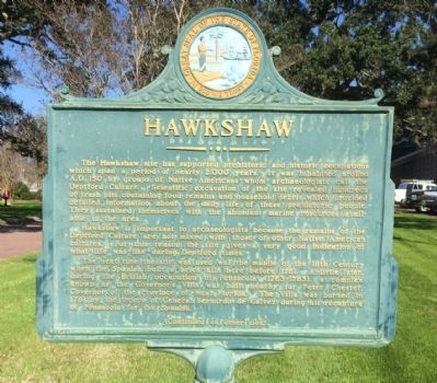
The Hawkshaw site has supported prehistoric and historic occupations which span a period of nearly 2,000 years. It was inhabited around A.D. 150 by groups of Native Americans whom archaeologists call the Deptford Culture. Scientific excavation of the site revealed hundreds of trash pits containing food remains and household debris which provided detailed information about the daily life of these prehistoric people. They sustained themselves with the abundant marine resources available in the area.
Hawkshaw is important to archaeologists because the remains of the Deptford Culture are not mixed with those of other Native American cultures. For this reason the site gives a very good indication of what life was like during Deptford times.
The next time the site was used was the middle of the 18th Century when the Spanish built a brick kiln here before 1761. A little later, during the British occupation of Pensacola (1763-1783), a complex known as the Governor's Villa was built nearby for Peter Chester, Governor of the Province of West Florida. The Villa was burned in 1781 by the troops of General Bernardo de Galvez during his recapture of Pensacola for the Spanish.
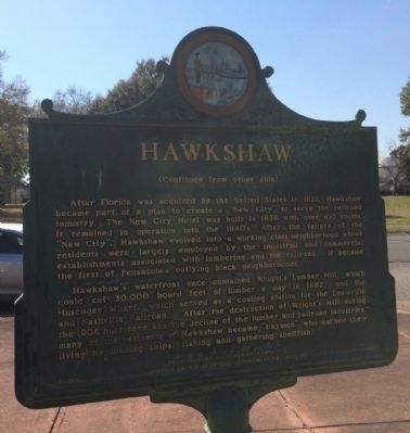
Hawkshaw's waterfront once contained Wright's Lumber Mill, which could cut 30,000 board feet of lumber a day in 1882, and the Muscogee Wharf, which served as a coaling station for the Louisville and Nashville Railroad. After the destruction of Wright's Mill during the 1906 hurricane and the decline of the lumber and railroad industries, many of the residents of Hawkshaw became "baymen" who earned their living by loading ships, fishing and gathering shellfish.
Erected 1987 by Gulf Power Company in cooperation with the Department of State. (Marker Number F-313.)
Topics. This historical marker is listed in these topic lists: Anthropology & Archaeology • Industry & Commerce • Native Americans • Railroads & Streetcars • Settlements & Settlers. A significant historical year for this entry is 1761.
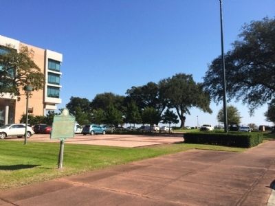
Location. 30° 24.884′ N, 87° 12.21′ W. Marker is in Pensacola, Florida, in Escambia County. Marker is on South 10th Avenue, 0.1 miles north of East Colfax Street, on the right when traveling north. Touch for map. Marker is at or near this postal address: 20 South 10th Avenue, Pensacola FL 32502, United States of America. Touch for directions.
Other nearby markers. At least 8 other markers are within walking distance of this marker. Historic John the Baptist Church (about 400 feet away, measured in a direct line); Revolutionary War Veterans Minuteman Memorial (about 600 feet away); "Submarine Lifeguard League" (about 600 feet away); Purple Heart Memorial (approx. 0.2 miles away); Maritime Prehistory (approx. 0.3 miles away); John Innerarity (approx. 0.3 miles away); St. Michaels Cemetery (approx. 0.3 miles away); Eugenio Antonio Sierra (approx. 0.3 miles away). Touch for a list and map of all markers in Pensacola.
Credits. This page was last revised on June 16, 2016. It was originally submitted on March 12, 2014, by Mark Hilton of Montgomery, Alabama. This page has been viewed 846 times since then and 75 times this year. Photos: 1, 2, 3. submitted on March 12, 2014, by Mark Hilton of Montgomery, Alabama. • Bernard Fisher was the editor who published this page.


