Near Medora in Jackson County, Indiana — The American Midwest (Great Lakes)
Medora Covered Bridge
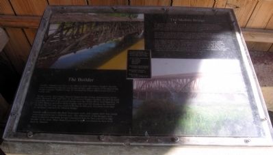
The Medora Bridge
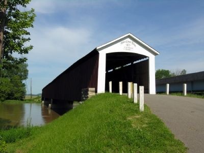
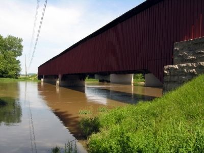
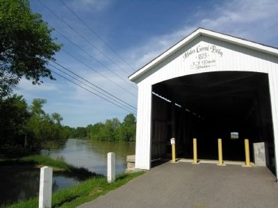
The Medora Covered Bridge was built in 1875 by noted timber bridge builder J.J. Daniels. It was built to carry local traffic across the East Fork of the White River forty years before there was a state highway system. In the early twentieth century, route US 50 crossed the river here, using this bridge. Later, and until 1972, State Road 235 crossed the river on this structure.
This bridge is the longest historic covered bridge in the nation. Its span between the abutment faces is 431 feet. Shed extensions for weather protection extend 16 feet on each end beyond the actual bridge span. The Medora Bridge is also the last remaining three-span covered bridge in Indiana.
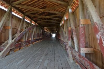
The bridge is classified as a Burr Arch truss, which combines timber arches with a stiffening truss. This is a sophisticated structural system in which the arches greatly strengthen the truss, and the truss keeps the arches in their proper curve. Daniels used oak for the bottom truss members, for the vertical posts, and for the deck. He used yellow poplar wood for the rest of the structure. You can see marks of hand-hewing on some of the top truss members. Wrought iron bolts and the rods clamp the many pieces together.
The Builder
Joseph J. Daniels was born in SE Ohio in 1826. His father, Stephen Daniels, was a prominent carpenter and bridge builder, and an agent of the pioneering bridge engineer Stephen Long. J.J. assisted his father and learned well as a young man.
At age twenty, the younger Daniels began to take bridge commissions on his own. Between 1847 and 1852 J.J. built several bridges in Ohio. In 1853 he built a notable 600-foot long covered bridge over the White River near Hazelton, IN. In 1861 Daniels moved to Parke County and went into business for himself. He built the 207-foot span Jackson Bridge in that year. Fourteen years later he designed and built the Medora Bridge.
Daniels came to prefer the Burr Arch truss style, and usually built that except when required to use a different type. The robustness of his designs were much respected, and many people considered him the best covered bridge builder in the state. More than 53 covered bridges are known to have been built by Daniels.
Topics and series. This historical marker is listed in these topic lists: Bridges & Viaducts • Roads & Vehicles. In addition, it is included in the Covered Bridges series list. A significant historical year for this entry is 1875.
Location. 38° 49.11′ N, 86° 8.882′ W. Marker is near Medora, Indiana, in Jackson County. Marker can be reached from State Road 235. Marker is accessible from a park
along the White River approximately one mile east of the town of Medora. Touch for map. Marker is in this post office area: Medora IN 47260, United States of America. Touch for directions.
Other nearby markers. At least 8 other markers are within 7 miles of this marker, measured as the crow flies. Medora Shale Brick Plant (approx. 1.3 miles away); Driftwood Church and Cemetery (approx. 2.9 miles away); Bartholomew Trail (approx. 3.2 miles away); Site of Fort Vallonia (approx. 3.2 miles away); Fort Vallonia (approx. 3.8 miles away); In Memory of Col. John Ketcham / Time Capsule (approx. 7 miles away); All Veterans Honor Roll Memorial (approx. 7.1 miles away); The Freedom Tree (approx. 7.1 miles away).
Regarding Medora Covered Bridge. The marker states the 2010 rehabilitation was funded by the National Historic Covered Bridge Preservation Program and Jackson County and lists the County officials and engineer and contractor for the project.
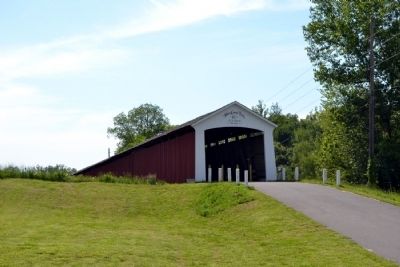
Photographed By Duane Hall, May 22, 2014
3. Medora Covered Bridge, east end
Bridge website homepage:
Click for more information.
Click for more information.
Credits. This page was last revised on December 21, 2021. It was originally submitted on May 28, 2014, by Duane Hall of Abilene, Texas. This page has been viewed 622 times since then and 42 times this year. Photos: 1, 2, 3, 4, 5, 6, 7. submitted on May 28, 2014, by Duane Hall of Abilene, Texas.
