Strasburg in Shenandoah County, Virginia — The American South (Mid-Atlantic)
Historic Strasburg
Stop # 5
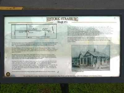
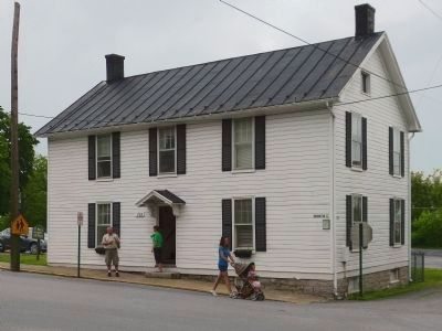
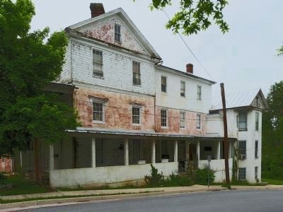
The large building at 189 Fort Street, to your left, was the Chalybeate Springs Hotel. It began catering to summer guests in the 1890's. Guests came by rail to the depot. Some were "drummers" (traveling salesmen) and others came to partake of the spring behind the hotel, believing the iron water to be healthful.
One block to your left is Capon Street, which leads to Route 55 West (once known as Capon Grade). From the town's platforms and rail stations many elite vacationers transferred to horse-drawn coaches for the trip to the Capon Spring Hotel in West Virginia. Before air conditioning, people flocked to the cooler mountains during hot summer months.
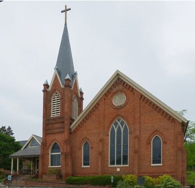
Strasburg's first church, the Lutheran Church, was a log structure built across the street in the late 1760's. For many years it was the town's only chapel, so other congregations held services here. In the early years, local laymen, such as Simon Harr, often ministered to the Lutheran congregation. County records show he performed 368 marriages between 1781 and 1796. He was also the schoolmaster for the school in Strasburg. For about 25 years, beginning in the early 1800's, the church employed two ministers at a time: one gave the sermon in German and the other in English.
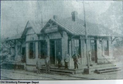
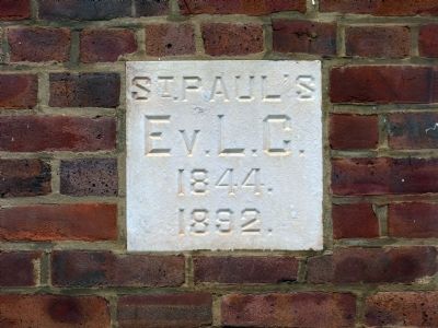
The log church was replaced by a brick structure in 1844 and dedicated at St. Paul's Lutheran Church. During the Civil War the church was ruined. The pulpit, pews, pipe organ, doors and windows were destroyed. By 1864 all that remained was the shell. After the war, the church filed a claim with the Federal government for compensation. The Lutheran Synod donated $200 and reconstruction of the sanctuary began in 1867. The church was extensively rebuilt in 1892 and the bell tower was completed in 1893. Additions were made in the 1920's and the west wing was added in 1954. The latest renovations were made in 1986 when the narthex was enlarged and the altar was moved from the north side of the building of the south side.
The church cemetery contains graves of many of Strasburg's prominent families. Adam Keister Sr., merchant, potter and elder of the church, is buried here, as is Solomon bell, another noted pottery-maker. And, sadly, there are many graves of young children who died before the age of modern medicine.
Erected by Strasburg Rotary. (Marker Number 5.)
Topics. This historical marker is listed in these topic lists: Cemeteries & Burial Sites • Churches & Religion • Railroads & Streetcars. A significant historical year for this entry is 1781.
Location. 38° 59.445′ N, 78° 21.77′ W. Marker is in Strasburg, Virginia, in Shenandoah County. Marker is at the intersection of West Washington Street and North Fort Street, on the left when traveling west on West Washington Street. Located in the parking lot of Saint Paul's Lutheran Church Annex. Touch for map. Marker is at or near this postal address: 193 West Washington Street, Strasburg VA 22657, United States of America. Touch for directions.
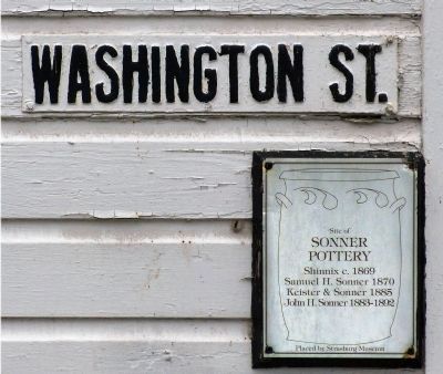
Other nearby markers. At least 8 other markers are within walking distance of this marker. Saint Paul’s Lutheran Church (a few steps from this marker); a different marker also named Historic Strasburg (about 400 feet away, measured in a direct line); Open House (about 400 feet away); Stonewall's Surprise (about 500 feet away); a different marker also named Historic Strasburg (about 700 feet away); American Legion (about 800 feet away); a different marker also named Historic Strasburg (approx. 0.2 miles away); Sonner House (approx. 0.2 miles away). Touch for a list and map of all markers in Strasburg.
Photographed By Allen C. Browne, May 14, 2014
6. Apartment Building at 189 Fort Street,
Formerly The Chalybeate Springs Hotel
Formerly The Chalybeate Springs Hotel
"The Chalybeate Spring Hotel on the southwest corner of Washington and Fort Streets catered to travelers from the 1890’s throughout the 1930’s, when it was converted into apartments." -- Strasburg Historic Walking Tour pamphlet.
Credits. This page was last revised on June 16, 2016. It was originally submitted on May 29, 2014, by Allen C. Browne of Silver Spring, Maryland. This page has been viewed 678 times since then and 19 times this year. Photos: 1, 2, 3, 4, 5, 6, 7, 8, 9, 10. submitted on May 29, 2014, by Allen C. Browne of Silver Spring, Maryland. • Bernard Fisher was the editor who published this page.
