Near Winchester in Clark County, Kentucky — The American South (East South Central)
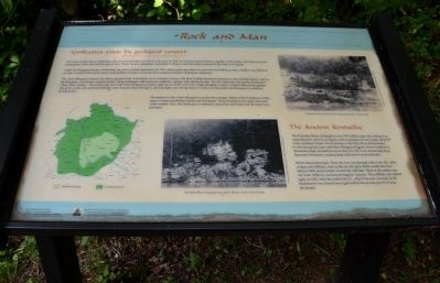
Rock and Man
"Civilization exists by geological consent"
(Will Durant (1885 - 1981), American historian, philosopher, and educator)
Not many people stop to think about the rock beneath their feet, but it is the type of rock, its structure and its history, together with climate, that determine the topography of the land and the type of soil. These, in turn, will determine what plants will grow and how much animal life the land will support.
Under the Bluegrass Region of Kentucky are layers of rock deposited over 400 million years ago, when this area was covered by a warm, shallow sea. Millions of years of uplift followed by many more millions of years of erosion have created Kentucky's Bluegrass landscape.
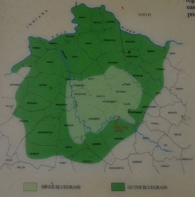
The Inner Bluegrass contains the oldest exposed rocks in Kentucky. As is common in areas with thick-bedded limestone formations and a humid climate, such as the Bluegrass, erosion has created a gently rolling landscape with numerous sinkholes, springs, and sinking streams. It is this landscape that typifies Kentucky's "horse farm country." The underlying rock in the Inner Bluegrass produces dark brown fertile soils with a high phosphate content. Animals that eat the grasses that grow on this soil, and that drink the water that percolates through it, develop light, very strong bones. It is this soil that makes the Bluegrass so suited to raising horses.
The bedrock of the Outer Bluegrass is somewhat younger. Many of the formations in this region contain interbedded shales and limestones. These formations are softer and more easily eroded. Here, the landscape is marked by steep hills and slopes, and flat land is at a premium.
The Ancient Kentucky
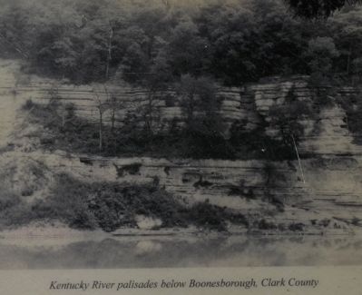
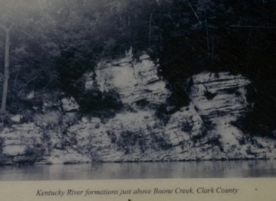
The Kentucky River is thought to be over 100 million years old, making it an extraordinarily old river. It begins in the mountains of Lee County, about 35 miles southeast of here. On its journey to the Ohio River, the Kentucky winds through the Inner and Outer Bluegrass Regions. From Frankfort to Boonesborough, located just across the river, the river cuts through thick limestone formations, creating steep walls known as the palisades.
Below Boonesborough, where the river cuts through softer rock, the valley widens and cliffsides, such as the one this trail climbs, border the river. Before 1800, dense forests covered the cliffsides. Most of this timber was cut in the 1800s by commercial logging concerns. This cliffside was cleared again in 1863 when the earthwork at the top of the trail was built. In all likelihood it was cleared once again before the present growth of trees developed.
Erected by The Winchester/Clark County Tourism Commission.
Topics. This historical marker is listed in this topic list: Natural Features. A significant historical year for this entry is 1800.
Location. 37° 53.394′ N, 84° 15.594′ W. Marker is near Winchester, Kentucky, in Clark County. Marker can be reached from Ford Road/4 Mile Road (Kentucky Route 1924) 1.2 miles south of Boonesboro Road (Kentucky Route 627), on the left when traveling south. The exhibit can be reached from the parking area on KY Route 1924. The trailhead is at the edge of the parking area here. This wayside exhibit can be found partway up the trail that leads to the fort at the top of the hill. Touch for map. Marker is at or near this postal address: 1250 Ford Road, Winchester KY 40391, United States of America. Touch for directions.
Other nearby markers. At least 8 other markers are within walking distance of this marker. Common Cliffside Plants (a few steps from this marker); The Eye of the Rich Land (a few steps from this marker); The Quest for Land (a few steps from this marker); A Long, Steep Road (within shouting distance of this marker); Roads in the Wilderness (within shouting distance of this marker); Defending the Kentucky River (within shouting distance of this marker); Three Confederate Raids (within shouting distance of this marker); Thomas B. Brooks, Army Engineer (within shouting distance of this marker). Touch for a list and map of all markers in Winchester.
More about this marker. This marker is part of the historic site known as the "Civil War Fort at Boonesboro." CAUTION: The climb up the hill is VERY steep.
Also see . . . Civil War Fort at Boonesboro. (Submitted on June 26, 2014, by Karl Stelly of Gettysburg, Pennsylvania.)
Credits. This page was last revised on June 16, 2016. It was originally submitted on June 24, 2014, by Karl Stelly of Gettysburg, Pennsylvania. This page has been viewed 500 times since then and 23 times this year. Photos: 1, 2, 3, 4. submitted on June 24, 2014, by Karl Stelly of Gettysburg, Pennsylvania. • Bill Pfingsten was the editor who published this page.


