Oswego in Oswego County, New York — The American Northeast (Mid-Atlantic)
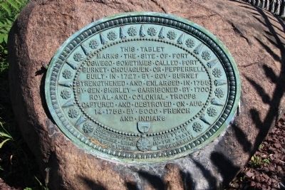
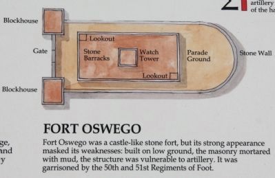
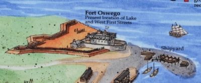
Fort Oswego
marks the site of Fort
Oswego sometimes called Fort
Burnet, Chouaguen, or Pepperrell.
Built in 1727 by Governor Burnet,
strengthened and enlarged in 1755
by General Shirley - garrisoned by 1700
royal and colonial troops,
captured and destroyed on August
14, 1756 by 5000 French
and Indians.
Erected 1898 by The Society of Colonial Wars in the State of New York.
Topics. This historical marker is listed in these topic lists: Forts and Castles • Native Americans • War, French and Indian. A significant historical year for this entry is 1727.
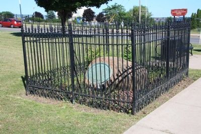
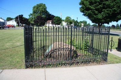
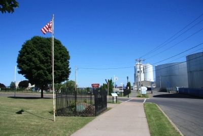
Location. 43° 27.699′ N, 76° 30.857′ W. Marker is in Oswego, New York, in Oswego County. Marker is at the intersection of West 1st Street and Lake Street, on the left when traveling north on West 1st Street. This historical marker is a plaque, affixed to a large boulder, situated within a small iron fenced in area, on the west side of the Oswego River, near the lake front. Touch for map. Marker is in this post office area: Oswego NY 13126, United States of America. Touch for directions.
Other nearby markers. At least 8 other markers are within walking distance of this marker. A different marker also named Fort Oswego (here, next to this marker); Oswego Harbor West Pierhead Lighthouse (approx. 0.2 miles away); Oswego Harbor (approx. 0.2 miles away); LT-5 TUG (approx. 0.2 miles away); Fort George (approx. 0.3 miles away); Open Water = Winter Birds (approx. 0.3 miles away); Wreck of the David W. Mills (approx. 0.3 miles away); Oswego West Side Forts (approx. 0.3 miles away). Touch for a list and map of all markers in Oswego.
Also see . . .
1. Fort Oswego. This is a link to information provided by Wikipedia, the free encyclopedia. (Submitted on July 15, 2014, by Dale K. Benington of Toledo, Ohio.)
2. Battle of Fort Oswego (1756). This is a link to information provided by Wikipedia, the free encyclopedia. (Submitted on July 15, 2014, by Dale K. Benington of Toledo, Ohio.)
Credits. This page was last revised on June 16, 2016. It was originally submitted on July 14, 2014, by Dale K. Benington of Toledo, Ohio. This page has been viewed 766 times since then and 40 times this year. Photos: 1, 2, 3, 4, 5, 6. submitted on July 15, 2014, by Dale K. Benington of Toledo, Ohio.
