Brockport in Monroe County, New York — The American Northeast (Mid-Atlantic)
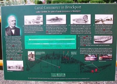
Canal Commerce in Brockport
Luther Gordon, the spirit of canal commerce in Brockport
1. Luther Gordon epitomized Brockport's involvement in canal commerce during its heyday. He owned a sawmill and 7,000 acres of timberland in Michigan and transported logs via the Great Lakes and the canal to his Brockport sawmill and planing mill (A). Finished products were shipped on the canal to all parts of New York State. Some years, he and other lumber dealers shipped 2 to 4 million board feet of lumber and 400,000 pounds of barrel staves on the canal.
Brockport boasted a toll station (C) on the canal. Gordon was the founder and president of the First National Bank of Brockport (B), repository of those tolls.
2. Freight: From 1823 until about 1880 line boats on the Erie Canal were the most important mode of transportation for bulky freight and were heavily used by Brockport's many manufacturing firms.
3. Agricultural Commodities: Brockport was the principal port for a large area of western New York and, in the late 19th century, claimed to be the largest bean shipping port in the world (D). Fruit, another major product of the area, was shipped in barrels on the canal.
4. Passengers: Canal packet boats were the main means by which some two million immigrants reached the American Midwest. Two lines were based in Brockport. Passenger fares fell as low as a half-cent per mile in the mid-19th century. The arrival of railroads in 1852 ended this traffic.
5. Industry: By 1880, mechanization was replacing horses and mules on the canal. In the early 20th century, Brockport's M.A. Cleveland Co. (E) was a major contractor for the reconstruction of the canal, still important for shipping freight.
6. The Thruway (F) and the Seaway (G) doomed most canal freight traffic. Oil barges still arrived in Brockport until an oil pipeline was completed in 1971 (H). Since then, almost no freight vessels pass through here.
7. Recreation & Tourism: New York State started promoting the canal for these purposes in 1990. The only commercial vessels that regularly tie up in Brockport are cruise boats and rental houseboats; 93 of them did so in 2008. During an ordinary season, 400-500 private boats also spend a night here.
[Timeline and map of Erie Canal through Brockport]
Erected 2011 by Brockport Community Museum, Express Mark and Northside Service Center.
Topics and series. This historical marker is listed in these topic lists: Industry & Commerce • Man-Made Features • Settlements & Settlers • Waterways & Vessels. In addition, it is included in the Erie Canal series list. A significant historical year for this entry is 1823.
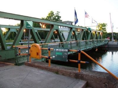
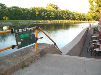
Location. 43° 12.99′ N, 77° 56.287′ W. Marker is in Brockport, New York, in Monroe County. Marker is at the intersection of Main Street (New York State Route 19) and the south end of the Erie Canal drawbridge, on the right when traveling north on Main Street. Touch for map. Marker is at or near this postal address: 1 Main Street, Brockport NY 14420, United States of America. Touch for directions.
Other nearby markers. At least 8 other markers are within walking distance of this marker. Brockport and the Canal (within shouting distance of this marker); Main Street Brockport Enterprises in the Early 1900s (about 300 feet away, measured in a direct line); American Revolutionary War Memorial (about 700 feet away); Main Street District (about 700 feet away); McCormick Reapers (about 800 feet away); St. Luke's Episcopal Church (approx. 0.2 miles away); Trolley Depot (approx. 0.2 miles away); Park Ave. / State St. Historic District (approx. 0.2 miles away). Touch for a list and map of all markers in Brockport.
Also see . . . Brockport History. Town website entry (Submitted on August 3, 2014, by William Fischer, Jr. of Scranton, Pennsylvania.)
Credits. This page was last revised on January 1, 2022. It was originally submitted on August 3, 2014, by William Fischer, Jr. of Scranton, Pennsylvania. This page has been viewed 386 times since then and 17 times this year. Photos: 1, 2, 3. submitted on August 3, 2014, by William Fischer, Jr. of Scranton, Pennsylvania.


