
Near Corning in Adams County, Iowa — The American Midwest (Upper Plains)
Icarian Colony
Photographed by Bill Kirchner, September 23, 2014
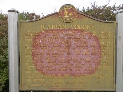
1. Icarian Colony Marker
Formed in France by Etienne Cabet, this group comprised of many talented and well-educated persons. All possessions surrendered to a common fund, all worked for common good.
Landed in New Orleans in 1848 all applied for citizenship, same year. Settled near Dallas, Texas, where many died of fever, the others returned to New Orleans. Later the same year they moved to Nauvoo, Ill. By 1854 they owned 1,500 acres of land.
In 1860, 235 of this group bought 9 sections of land in Adams County, Iowa, four miles East of Corning. Buildings were placed in a parallelogram around a central dining and recreation hall. The school house is now Prescott No. 8, still standing.
Colony dissolved in 1895. Cemetery and three buildings privately owned are ¾ miles North of this marker.
Much of the 2,000 volume library is in the University of Omaha.
Erected by Corning Iowa BPW Club.
Topics. This historical marker is listed in these topic lists: Immigration • Settlements & Settlers. A significant historical year for this entry is 1848.
Location. 40° 58.773′ N, 94° 40.832′ W. Marker is near Corning, Iowa, in Adams County. It
this page online

Regionally, this marker is in Southern Iowa. It is also in the American Midwest and in the Corn Belt. Globally, it is in North America, the Western Hemisphere, the Western World, and the Anglosphere. Historically, it finds itself in what was once the territory of the Mississippian Culture and also the Louisiana Purchase.
Other nearby markers. At least 8 other markers are within 4 miles of this marker, measured as the crow flies: Corning Freedom Rock Veterans Memorial (approx. 2.8 miles away); Veterans Memorial (approx. 2.9 miles away); Fairview Church (approx. 3 miles away); City of Corning Fire Bell (approx. 3 miles away); Mt. Etna United Methodist Church (approx. 3 miles away); Adams County Jail (approx. 3 miles away); First Adams County Mill (approx. 3 miles away); The Bell (approx. 3.1 miles away). Touch for a list and map of
Photographed by Bill Kirchner, September 23, 2014
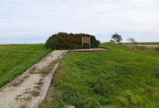
2. Icarian Colony Marker
Related marker. Click here for another marker that is related to this marker.
Credits. This page was last revised on January 6, 2026. It was originally submitted on October 18, 2014, by Bill Kirchner of Tucson, Arizona. This page has been viewed 2,783 times since then and 273 times this year. Last updated on January 6, 2026, by James King of San Miguel, California. Photos: 1, 2. submitted on October 18, 2014, by Bill Kirchner of Tucson, Arizona. • Devry Becker Jones was the editor who published this page.
