Little Falls in Morrison County, Minnesota — The American Midwest (Upper Plains)
Lindbergh State Park
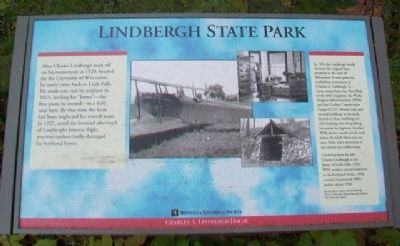
After Charles Lindbergh took off on his motorcycle in 1920, headed for the University of Wisconsin, he rarely came back to Little Falls. He made one visit by airplane in 1923, landing his "Jenny" - the first plane he owned - in a field near here. By that time the farm had been neglected for several years. In 1927, amid the frenzied aftermath of Lindbergh's historic flight, souvenir-seekers badly damaged his boyhood home.
In 1931 the Lindbergh family donated the original farm property to the state of Minnesota. A state park was established in memory of Charles A. Lindbergh, Sr. Later, teams from two New Deal work-relief programs, the Works Progress Administration (WPA) and the Civilian Conservation Corps (CCC), cleared trails and erected buildings in the park. Several of these buildings are still standing near the parking lot across the highway. Another WPA shelter stood several yards below the bluff where you are now. Only a few remnants of this shelter are visible today.
[Photos] Clockwise from far left:
Charles Lindbergh in his Jenny in Little Falls, 1923;
WPA workers restore furniture in the boyhood home, 1936;
A newly constructed WPA shelter, about 1936.
Far-left photo courtesy of the Lindbergh Picture Collection, Manuscripts and Archives, Yale University Library
Erected by Minnesota Historical Society.
Topics and series. This historical marker is listed in these topic lists: Air & Space • Charity & Public Work • Environment • Parks & Recreational Areas. In addition, it is included in the Civilian Conservation Corps (CCC), the Minnesota Historical Society, and the Works Progress Administration (WPA) projects series lists. A significant historical year for this entry is 1920.
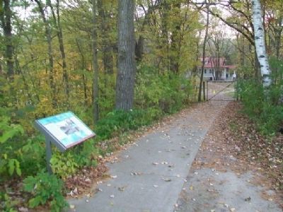
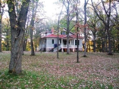
Location. 45° 57.543′ N, 94° 23.244′ W. Marker is in Little Falls, Minnesota, in Morrison County. Marker is on Lindbergh Drive South, on the left when traveling south. Marker is along the path leading from the Charles A. Lindbergh Historic Site Visitor Center to the Lindbergh home. Touch for map. Marker is at or near this postal address: 1620 Lindbergh Drive South, Little Falls MN 56345, United States of America. Touch for directions.
Other nearby markers. At least 8 other markers are within walking distance of this marker. Lindbergh House (within shouting distance of this marker); A Boyhood on the Mississippi (within shouting distance of this marker); Little Falls and the Mississippi River (about 300 feet away, measured in a direct line); Tenant Farmer House (about 600 feet away); WPA Water Tower & Shelter Building (approx. 0.2 miles away); Childhood Memories of a Magical Place (approx. 0.2 miles away);
The Boyhood Farm of Charles Lindbergh (approx. 0.2 miles away); The WPA Builds a Park in the Rustic Style (approx. 0.2 miles away). Touch for a list and map of all markers in Little Falls.
Also see . . .
1. Charles A. Lindbergh State Park MN. Minnesota Department of Natural Resources website entry (Submitted on October 22, 2014, by William Fischer, Jr. of Scranton, Pennsylvania.)
2. Charles A. Lindbergh House and Museum. Minnesota Historical Society website entry (Submitted on October 21, 2014, by William Fischer, Jr. of Scranton, Pennsylvania.)
Credits. This page was last revised on July 14, 2023. It was originally submitted on October 21, 2014, by William Fischer, Jr. of Scranton, Pennsylvania. This page has been viewed 534 times since then and 28 times this year. Photos: 1, 2, 3. submitted on October 22, 2014, by William Fischer, Jr. of Scranton, Pennsylvania.


