Sodus Point in Wayne County, New York — The American Northeast (Mid-Atlantic)
A French Inspired Flotilla
Travel Through Wilderness
— French & Indian War —
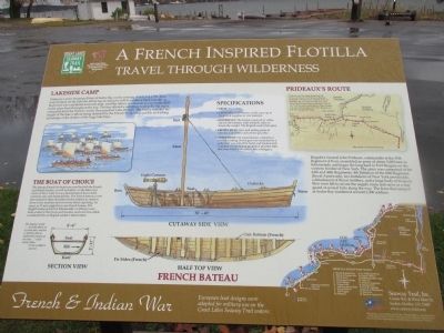
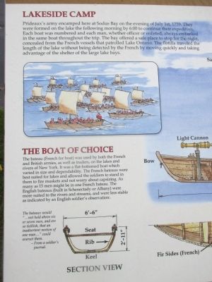
Lakeside Camp. Prideaux's army encamped here at Sodus Bay on the evening of July 1st, 1759. They were formed on the lake the following morning by 6:00 to continue their expedition. Each boat was numbered and each man, whether officer or enlisted, always embarked in the same boat throughout the trip. The bay offered a safe place to stop for the night, concealed from the French vessels that patrolled Lake Ontario. The flotilla traveled the length of the lake without being detected by the French by moving quickly and taking advantage of the shelter of the large lake bays.
The Boat of Choice. The bateau (French for boat) was used by both the French and British armies, as well as traders, on the lakes and rivers of New York. It was a flat-bottomed boat which varied in size and dependability. The French bateaux were best suited for lakes and allowed the soldiers to stand in them to fire muskets and not worry about capsizing. As many as 15 men might be in one French bateau. The English bateaux (built in Schenectady or Albany) were more suited to the rivers and streams, and were less stable as indicated by an English soldier's observation: The bateaux would "...not hold above six or seven men, and are so ticklish, that an inadvertant motion of one man..." could overset them. - From a soldier's journal.
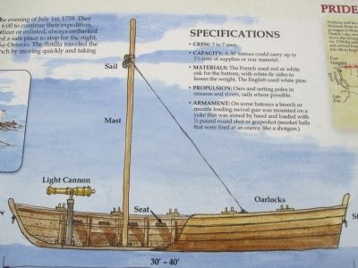
French Bateau. Section View. Cutaway Side View. Half Top View.
Specifications:
• Crew: 3 to 7 men
• Capacity: A 30' bateau could carry up to 1½ tons of supplies or war materiel.
• Materials: The French used red or white oak for the bottom, with white fir sides to lessen the weight. The English used white pine.
• Propulsion: Oars and setting poles in streams ans rivers, sails where possible.
• Armament: On some bateaux a breech or muzzle loading swivel gun was mounted on a yoke that was aimed by hand and loaded with ½ pound round shot or grapeshot (musket balls that were fired ay an enemy like a sdhotgun.)
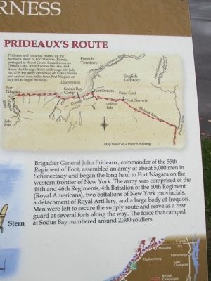
Prideaux's Route Prideaux and his army boated up the Mohawk River to Fort Stanwix (Rome), portaged to Wood Creek, floated down to Oneida Lake, rowed across the lake, and down the Oswego River to Oswego. On July 1st, 1759 the army embarked on Lake Ontario and arrived four miles from Fort Niagara on July 6th to begin the siege.
Brigadier General John Prideaux, commander of the 55th Regiment of Foot, assembled an army of about 5,000 men in Schenectady and began the long haul to Fort Niagara on the western frontier of New York. The army was comprised of the 44th and 46th Regiments, 4th Battalian of the 60th Regiment (Royal Americans), two battalions of New York Provincials, a detachment of Royal Artillery, and a large body of Iroquois. Men were left to secure the supply route and serve as a rear guard at several forts along the way. The force that camped at Sodus Bay numbered around 2,300 soldiers.
European boat designs were adopted for military use on the Great Lakes Seaway Trail waters.
French and Indian War Panels. [20 Seaway Trail panels listed with numbers on map.]
Seaway Trail, Inc., Corner Ray and West Main St.., Sackets Harbor, NY 13685. www.seawaytrail.com . America's Byways. This project was funded in part by the Federal Highway Administration and administered by the New York State Scenic Byways Program of the New york State Department of Transportation and Seaway Trail, Inc.
Erected by Seaway Trail, Inc.
Topics and series. This historical marker is listed in these topic lists: War, French and Indian • Waterways & Vessels. In addition, it is included in the Great Lakes Seaway Trail National Scenic Byway series list. A significant historical date for this entry is July 1, 1759.
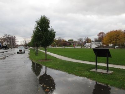
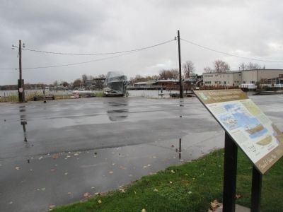
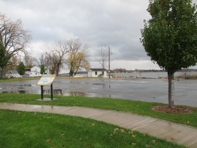
Location. 43° 16.272′ N, 76° 58.824′ W. Marker is in Sodus Point, New York, in Wayne County. Marker is on New York State Route 14, on the left when traveling east. Marker is along a park walkway and parking lot on the north side of NY Route 14. The park is triangular, bordered by Bay Street at the west, Wickham Boulevard at the north, and boat docks and slips on Sodus Bay at the west, with the parking lot entrance off NY 14 at the southern point of the park. Willow Park is on the south side of NY 14. If you miss the turn into the parking lot, you will dead end on a narrow spit of land in the bay. Touch for map. Marker is in this post office area: Sodus Point NY 14555, United States of America. Touch for directions.
Other nearby markers. At least 8 other markers are within walking distance of this marker. Historic Sodus Point (about 500 feet away, measured in a direct line); Battle of Sodus Point (about 700 feet away); The War of 1812 (about 700 feet away); Site of 1825 Keeper's Dwelling House (approx. 0.3 miles away); Site of the Original Sodus Bay Lighthouse (approx. 0.3 miles away); Big Sodus Light (approx. 0.3 miles away); Sodus Point Lighthouse (approx. 0.4 miles away); British Raids (approx. 0.4 miles away). Touch for a list and map of all markers in Sodus Point.
Related marker. Click here for another marker that is related to this marker. Gen. Prideaux landing to siege Ft. Niagara.
Credits. This page was last revised on June 16, 2016. It was originally submitted on December 13, 2014, by Anton Schwarzmueller of Wilson, New York. This page has been viewed 674 times since then and 20 times this year. Photos: 1, 2, 3, 4, 5, 6, 7. submitted on December 13, 2014, by Anton Schwarzmueller of Wilson, New York. • Bill Pfingsten was the editor who published this page.
