Columbia Heights in Northwest Washington in Washington, District of Columbia — The American Northeast (Mid-Atlantic)
Washington Meridian
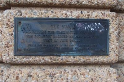
"The Stone"
— 1804 - 1923 —
Erected by Army and Navy Chapter, Daughters of the American Revolution.
Topics and series. This historical marker is listed in these topic lists: Communications • Environment • Roads & Vehicles. In addition, it is included in the Daughters of the American Revolution series list.
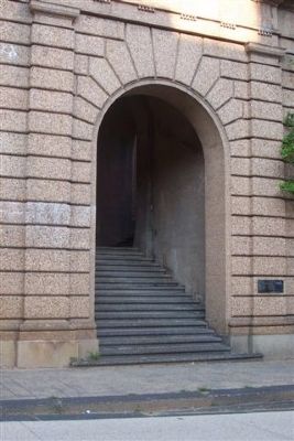
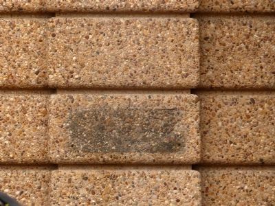
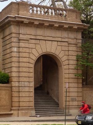
Location. Marker has been reported missing. It was located near 38° 55.293′ N, 77° 2.18′ W. Marker was in Northwest Washington in Washington, District of Columbia. It was in Columbia Heights. Marker could be reached from 16th Street Northwest north of Crescent Place Northwest, on the right when traveling north. Marker is on the retaining wall near stairs leading up to Meridian Hill/Malcolm X Park. Touch for map. Marker was at or near this postal address: 2420 16th Street Northwest, Washington DC 20009, United States of America. Touch for directions.
Other nearby markers. At least 8 other markers are within walking distance of this location. Art for the People (a few steps from this marker); The Envoy (within shouting distance of this marker); Park Tower (within shouting distance of this marker); An American Meridian (about 300 feet away, measured in a direct line); Meridian Hill / Malcolm X Park (about 300 feet away); College Hill (about 300 feet away); Visionary and Park Champion (about 300 feet away); Creating the "City Beautiful" (about 300 feet away). Touch for a list and map of all markers in Northwest Washington.
More about this marker. The original "stone," a small freestone obelisk placed in 1804, marked the northern end of 16th Street, NW, at Meridian Hill. This point was directly north of the White House on the so-called Washington or "White House" Meridian, the established east-west longitudinal divide and official starting point for U.S. map makers prior to 1884. In the early 1900s, 16th Street was extended northward, and the stone was lost.
Also see . . . Washington Meridian. (Submitted on December 29, 2008, by Richard E. Miller of Oxon Hill, Maryland.)
Additional commentary.
1. Establishing and Marking the 16th Street Meridian
Frank L. Cuffey, in
Geodetic Letter, March 1936, describes the establishment and marking of the 16th Street meridian:
"In 1804, Nicholas King under the direction of a Mr. Brigg, laid out a meridian through the center of the President's house. This was also established by celestial observation by setting up a transit at the northern door of the President's house and pointing to the star in the tail of the constellation Ursa Minor at its eastern elongation, and continuing the vertical circle to the ground, he determined the bearing, in line of which on very low stand was placed one of Argand's lamps covered by a tin cylinder, in which a small slit was made for a sight, and the line from the light toward the instrument was drawn upon the stand. This stand was located on the northern side of I Street at the intersection of Sixteenth street. Turning back toward the west with the transit through the horizontal angle formed by the eastern elongation and the upper culmination of Polaris, a point was found on top of a hill nearly two miles due north of the president's house, on the lands of Mr. Robert Peter. This line was temporarily marked with wooden posts and later, with Mr. Peter's permission, a small obelisk of freestone was placed so that its apex was in the true meridian from the center of the north door of the President's house. From this survey the names 'Meridian Hill' and 'Meridian
Photographed By Allen C. Browne
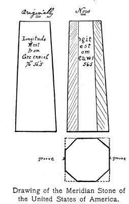
3. Drawing of the Meridian Stone
Alice Morse Earle in her 1902 book Sundials and Roses describes the fate of the stone that marked the 16th street meridian at Meridian Hill: "The true meridian stone, set in 1804, stood where placed until sometime in the (eighteen) seventies, when Meridian Hill was graded down. The stone was carried to the District building and thrown in a rubbish heap. Later, when Lieutenant Hoxie was on duty, it was sent to the Reform School and set up as a hitching post." She provided this drawing of the stone.
— Submitted March 16, 2013, by Allen C. Browne of Silver Spring, Maryland.
Additional keywords. astronomy, cartography, navigation, surveying.
Photographed By Richard E. Miller, August 4, 2008
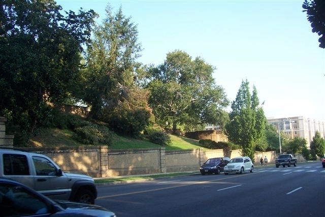
4. 16th Street, NW - formerly the Washington or "White House" Meridian
View of the western boundary of Meridian Hill/Malcolm X Park, the dividing line between the Columbia Heights and Adams-Morgan neighborhoods, looking south toward Florida Avenue and U Street, NW.
Credits. This page was last revised on January 30, 2023. It was originally submitted on December 29, 2008, by Richard E. Miller of Oxon Hill, Maryland. This page has been viewed 2,138 times since then and 23 times this year. Last updated on April 20, 2015, by Allen C. Browne of Silver Spring, Maryland. Photos: 1, 2. submitted on December 29, 2008, by Richard E. Miller of Oxon Hill, Maryland. 3. submitted on March 16, 2013, by Allen C. Browne of Silver Spring, Maryland. 4. submitted on December 29, 2008, by Richard E. Miller of Oxon Hill, Maryland. 5, 6. submitted on April 20, 2015, by Allen C. Browne of Silver Spring, Maryland. • Bill Pfingsten was the editor who published this page.
