Near East Bernstadt in Laurel County, Kentucky — The American South (East South Central)
Nerve Center for the Union Army
(Marker #1)
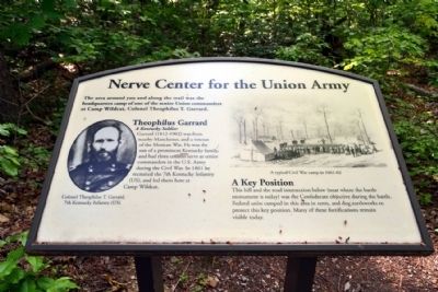
Nerve Center for the Union Army
The area around you and along the trail was the headquarters camp of one of the senior Union commanders at Camp Wildcat, Colonel Theophilus T. Garrard.
Theophilus Garrard
A Kentucky Soldier
Garrard (1812-1902) was from nearby Manchester, and a veteran of the Mexican War. He was the son of a prominent Kentucky family, and had three cousins serve as senior commanders in the U.S. Army during the Civil War. In 1861 he recruited the 7th Kentucky Infantry (US), and led them here at Camp Wildcat.
A Key Position
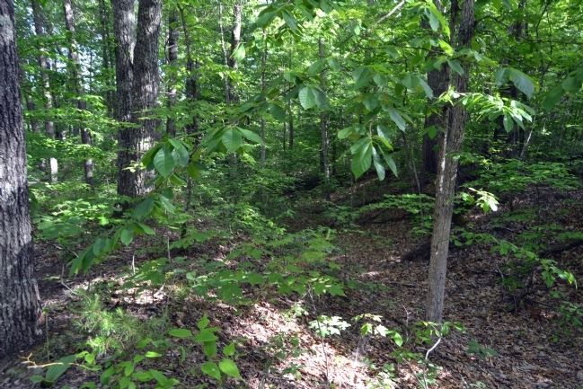
This hill and the road intersection below (near where the battle monument is today) was the Confederate objective during the battle. Federal units camped in this area in tents, and dug earthworks to protect this key position. Many of these fortifications remain visible today.
(Marker #2)
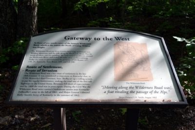
Gateway to the West
In front of you stands a part of the historic Wilderness Road, which is the reason the Battle of Camp Wildcat was fought.
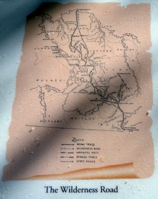
The Wilderness Road ran from Cumberland Gap northward over Wildcat Mountain and the hills along the Rockcastle River. Not far north of where you are standing, the road turned northwest, crossed the Rockcastle River, and ended 60 miles away at Harrodsburg. Today the route is approximated by portions of US Routes 127, 150, 25, Kentucky State Route 229, and US 25E.
Route of Settlement, Route of Invasion
The Wilderness Road was a key route of settlement in the late 18th Century. It was considered so important to Kentucky that, in 1795, Kentuckyís first Governor, Isaac Shelby set up a tolling system to pay for regular maintenance, making the road one of the first toll highways in the United States. Revenues fell short of expectations, and by 1860 the road was in poor repair. During the Civil War the Wilderness Road twice carried Confederate armies into Kentucky: Zollicofferís army in the fall of 1861, and Major General Edmund Kirby Smithís Army of Kentucky in the summer of 1862.
“(Moving along the Wilderness Road was) a feat rivaling the passage of the Alps.”
Major General E.K. Smith, August 1862
(Marker #3)
Artillery Anchors the Federal Defense
You are standing at the position of two Union cannons, part of Captain William Standartís Battery B, 1st Ohio Light Artillery from Cleveland. The cannon pits before you were probably dug after the battle. Standartís men played a key role in the Federal victory at Camp Wildcat.
A Buckeye Stand
Standartís Battery was supported by Colonel James B. Steedmanís 14th Ohio, which had been recruited in Toledo two months before. Both units arrived while the battle was in progress, and found Federal campsites blocking their way. The Ohioans tossed the tents aside, and took position along this ridge. Standartís artillery silenced the Confederate cannon after two shots, and shelled the Confederate infantry for the rest of the day.
“The Rebels were making efforts to drive the 33rd Indiana from their position (on Hoosier Knob). Every shot from our guns told with good effect.”
Private O.P. Catser, Battery B, 1st Ohio Light Artillery
(Left Illustration Caption)
The 33rd Indiana on Hoosier Knob. This drawing by a participant shows Standartís guns and the 14th Ohio in the background supporting the defense.
Topics. This historical marker is listed in these topic lists: Roads & Vehicles • War, US Civil. A significant historical year for this entry is 1861.
Location. 37° 15.876′ N, 84° 12.058′ W. Marker is near East Bernstadt, Kentucky, in Laurel County. Marker can be reached from Old Wilderness Road, 0.1 miles south of Camp Wildcat Road (Sheltowee Trace). Marker is located along the Infantry Ridge Interpretive Trail at the Camp Wildcat Battlefield; the above directions are to the Camp Wildcat Battlefield parking area. Directions to the
battlefield parking area are clearly marked from both Interstate 75 (Exit 49) and US Route 25. Touch for map. Marker is in this post office area: East Bernstadt KY 40729, United States of America. Touch for directions.
Other nearby markers. At least 8 other markers are within 3 miles of this marker, measured as the crow flies. Battle of Camp Wildcat (within shouting distance of this marker); a different marker also named Battle of Camp Wildcat (about 300 feet away, measured in a direct line); The Battle of Wildcat (about 300 feet away); Camp Wildcat (about 300 feet away); Camp Wildcat and the Wilderness Road (approx. 0.3 miles away); Skaggs Trace (approx. 1.9 miles away); a different marker also named Camp Wildcat (approx. 2.2 miles away); Congressional Medal of Honor (approx. 2.4 miles away). Touch for a list and map of all markers in East Bernstadt.
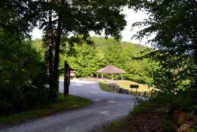
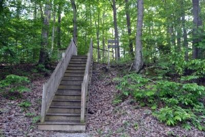
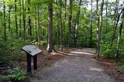
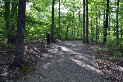
More about this marker. Markers are located along the Infantry Ridge Interpretive Trail. The trail is accessible by a wooden stairway from Old Wilderness Road just north of the Camp Wildcat Battlefield parking area. The trail is a graveled path 1/2 mile in length (round-trip).
Also see . . .
1. Battle of Camp Wildcat - Wikipedia entry. (Submitted on June 13, 2015.)
2. Wilderness Road - Wikipedia entry. (Submitted on June 13, 2015.)
3. Camp Wildcat Preservation Foundation. Official website of the organization preserving the battlefield and making visitor improvements
to the site. (Submitted on June 13, 2015.)
Credits. This page was last revised on November 13, 2020. It was originally submitted on June 13, 2015, by Duane Hall of Abilene, Texas. This page has been viewed 503 times since then and 19 times this year. Photos: 1, 2, 3. submitted on June 13, 2015, by Duane Hall of Abilene, Texas. 4. submitted on June 11, 2015, by Duane Hall of Abilene, Texas. 5, 6, 7, 8. submitted on June 13, 2015, by Duane Hall of Abilene, Texas.
Editor’s want-list for this marker. Photos of Marker # 3 (Artillery Anchors the Union Defense), exhibit cannons, and trail near marker. • Can you help?
