Charleston in Kanawha County, West Virginia — The American South (Appalachia)
The New Deal In Your Community
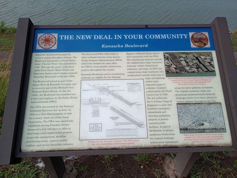
Kanawha Boulevard
The Boulevard served as part of the James River & Kanawha Turnpike and is currently part of the Midland Trail National Scenic Byway. In the late 1930s, the Boulevard was modified into a four-lane highway by the Public Works Administration (PWA).
The PWA was formed by the National Industrial Recovery Act on June 16, 1933 as a New Deal program to help the country climb out of the Great Depression. The PWA was signed into legislation during Franklin Delano Roosevelt's first 100 days in office to fund large-scale construction projects to provide employment, stabilize purchasing power, improve public welfare, and revive American industry.
The short lived PWA (1933-1941) is often confused with the better known Works Progress Administration (WPA which was created two years after the PWA to fund smaller construction projects throughout the country.
Kanawha Boulevard and its contributing elements are eligible for the National Register of Historic Places due to their association with the PWA. The contributing elements include the original stone slope treatment, drainage outlets, recreational pathways and steps. In 2014, the original stone slope treatment was enscapsulated and the lower sets of steps and drainage outlets were removed as part of a Section 14 project authorized by the Flood Control Act of 1946. The Act authorizes the U.S. Army Corps of Engineers to plan and construct emergency streambank and shoreline protection projects to protect essential public facilities. As part of the Section 14 project, sandstone blocks from the original drainage outlets were repurposed along the lower pathway as benches. The original sandstone steps and remaining sandstone blocks from the drainage outlets have been utilized in various projects throughout the City.
Illustration
Design details from the original 1938 PWA plans fro the stone steps and drainage outlets.
Upper Photo
Stone steps and drainage outlets prior to removal as part of the U.S. Army Corps of Engineers Section 14 Emergency Streambank and Shoreline Protection Project.
Lower Photo
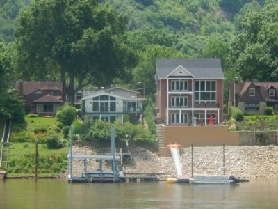
Stone slope treatment and drainage outlet completed in 2014 through a partnership between the U.S. Army Corps of Engineers and the City of Charleston.
Topics. This historical marker is listed in these topic lists: Charity & Public Work • Roads & Vehicles • Waterways & Vessels. A significant historical month for this entry is June 1825.
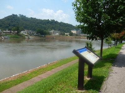
Location. 38° 20.11′ N, 81° 36.683′ W. Marker is in Charleston, West Virginia, in Kanawha County. Marker is on Kanawha Boulevard (U.S. 60), on the right when traveling east. Marker is across from the State Capitol. Touch for map. Marker is at or near this postal address: 1900 Kanawha Blvd E, Charleston WV 25305, United States of America. Touch for directions.
Other nearby markers. At least 8 other markers are within walking distance of this marker. Thomas J. Jackson (within shouting distance of this marker); State Capitol (about 300 feet away, measured in a direct line); Abraham Lincoln (about 400 feet away); Abraham Lincoln Walks At Midnight (about 400 feet away); Zero Mile Stone (about 400 feet away); West Virginia Home Guards (about 700 feet away); The Restoration Chestnut (about 800 feet away); Union Civil War Monument (about 800 feet away). Touch for a list and map of all markers in Charleston.
Additional commentary.
1. additional information
The metal plaques near the stones along the path connect the marker to the stones themselves. I suggested this while we were working on the final wording of the intrepretative sign and thought the stones needed to be identified to the historical PWA project.
— Submitted November 27, 2017, by Ernest Everett Blevins of Charleston, West Virginia.
Credits. This page was last revised on July 5, 2023. It was originally submitted on July 9, 2015, by Bill Pfingsten of Bel Air, Maryland. This page has been viewed 403 times since then and 21 times this year. Photos: 1. submitted on July 3, 2023, by Craig Doda of Napoleon, Ohio. 2, 3, 4. submitted on July 9, 2015, by Bill Pfingsten of Bel Air, Maryland.


