Fort Allen
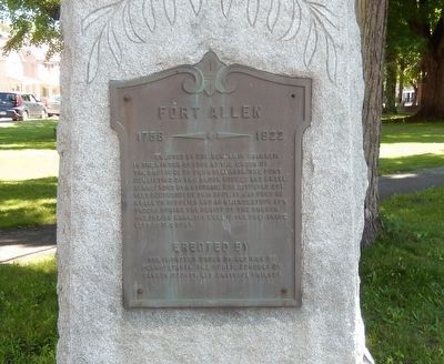
1756-1922
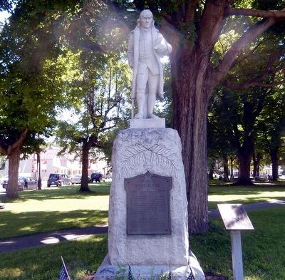
Erected by Col. Benjamin Franklin in the winter of 1758 at the order of the Province of Pennsylvania. The fort consisting of the two block houses and a well, surrounded by a stockade, was situated 201 feet southwest of this spot. It was used as a base of supplies and as a rendezvous for troops during the period of the French and Indian Wars. The well is the only trace left of the fort.
Erected by The Improved Order of Red Men of Pennsylvania, the Public Schools of Carbon County.
Topics. This historical marker is listed in these topic lists: Colonial Era • Forts and Castles • War, French and Indian. A significant historical year for this entry is 1758.
Location. 40° 49.777′ N, 75° 42.14′ W. Marker is in Weissport, Pennsylvania, in Carbon County. Marker is on Franklin Street. The marker is located in Weissport Borough Park. Touch for map. Marker is in this post office area: Lehighton PA 18235, United States of America. Touch for directions.
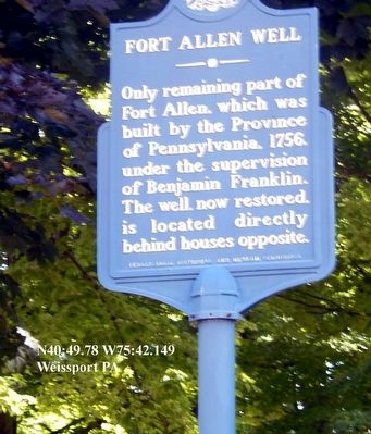
Other nearby markers. At least 8 other markers are within walking distance of this marker. Fort Allen Well (a few steps from this marker); Betty Mullen Brey (a few steps from this marker); Jacob Weiss Memorial (about 300 feet away, measured in a direct line); The Hub in its Heyday (approx. 0.2 miles away); Exploring the Corridor (approx. 0.2 miles
Also see . . . MarkerQuest - Fort Allen and Fort Allen Well. Further information and links relating to Fort Allen and its well. (Submitted on June 17, 2020, by Laura Klotz of Northampton, Pennsylvania.)
Credits. This page was last revised on June 18, 2020. It was originally submitted on August 8, 2015, by Don Morfe of Baltimore, Maryland. This page has been viewed 651 times since then and 52 times this year. Photos: 1, 2, 3. submitted on August 8, 2015, by Don Morfe of Baltimore, Maryland. • Bill Pfingsten was the editor who published this page.


