Near Mathiston in Webster County, Mississippi — The American South (East South Central)
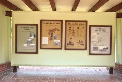
The Natchez Trace Parkway
(Marker #1)
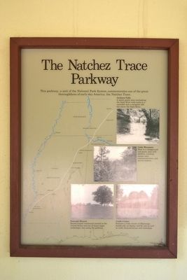
The Natchez Trace Parkway
This parkway, a unit of the National Park System, commemorates one of the great thoroughfares of early-day America: the Natchez Trace.
(Photo Captions)
Jackson Falls
A scenic picnic area overlooking the Duck River with trails to a waterfall and a viewpoint 300 feet above the Duck River.
Little Mountain
Here is a campground and picnic area with exhibits, overlook, nature trail, convenience store, and service station.
Emerald Mound
Second largest ceremonial mound in the United States and one of the many major archeologic sites along the parkway.
Crafts Center
Features a wide variety of Mississippi handicrafts on display and for sale as well as crafts demonstrations and workshops.
(Marker #2)
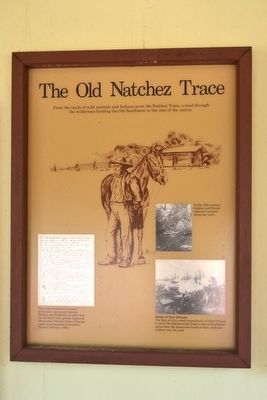
The Old Natchez Trace
From the trails of wild animals and Indians grew the Natchez Trace, a road through the wilderness binding the Old Southwest to the rest of the nation.
In the 18th century, Indians and French explorers traveled along the trails.
The United States Government authorized a post road between Natchez and Nashville in 1800. Soon the old trails were greatly improved. (Postmaster General Gideon Granger urged improvements to President Thomas Jefferson, 1806.)
Battle of New Orleans
The War of 1812 end triumphantly at New Orleans in 1815. The folklore of the Trace in the old Southwest stems from the homeward march of Gen. Jackson’s soldiers over the road.
(Marker #3)
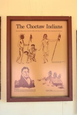
The Choctaw Indians
From the 16th century until the 1830's, the Choctaw lived in the region adjoining the Parkway.
(Drawing Captions)
Choctaws in the early 1700's, when the French dominated the area.
Pushmataha
The Choctaw were never at war with the Americans. Under the influence of Pushmataha (1764-1824), the greatest of all Choctaw chiefs, they refused to join anti-American alliances.
Choctaw Village
In 1800, about 20,000 lived in present-day Mississippi.
(Marker #4)
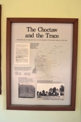
The Choctaw and the Trace
The Indians played important roles in the development of this pioneer highway, 1800-1830.
(Figure Captions)
Treaty of Fort Adams
In 1801, the Choctaw permitted the United States to open the Natchez Trace, through their lands.
Choctaw Lands and Cessions, 1800 - 1830.
The Choctaw claimed most of the present state of Mississippi. By 1830, they had ceded all this territory to the United States.
French Camp Marker
The Indians established inns along the Trace. Some carved farms out of the wilderness. They made rapid progress in self-government and began to accept the white man’s way of living.
Playing Stick-Ball, Philadelphia, Miss.
After 1830, the tribe moved to Oklahoma. A number remained in Mississippi, however, where their descendants reside today.
Erected by National Park Service.
Topics and series. This historical marker is listed in these topic lists: Native Americans • Roads & Vehicles. In addition, it is included in the Natchez Trace series list. A significant historical year for this entry is 1800.
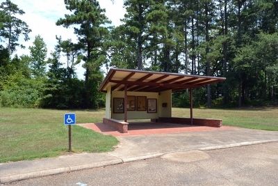
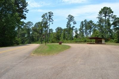
Location. 33° 32.375′ N, 89° 8.681′ W. Marker is near Mathiston, Mississippi, in Webster County. Marker is on Natchez Trace Exit Road, 0.2 miles east of Natchez Trace Parkway, on the left when traveling east. Marker is located on the access road connecting the Natchez Trace Parkway to US 82 East. Touch for map. Marker is in this post office area: Mathiston MS 39752, United States of America. Touch for directions.
Other nearby markers. At least 8 other markers are within 11 miles of this marker, measured as the crow flies. Natchez Trace at Mathiston (approx. ¾ mile away); Pigeon Roost (approx. 0.8 miles away); Charles Lindbergh Landing Site (approx. 2.7 miles away); The Old Natchez Trace (approx. 5.7 miles away); Eupora (approx. 7.2 miles away); Line Creek (approx. 8.9 miles away); Webster County Courthouse (approx. 9 miles away); The Great Eastern Hardwood Forest (approx. 11 miles away). Touch for a list and map of all markers in Mathiston.
Also see . . . Natchez Trace Parkway. Official National Park Service website. (Submitted on August 21, 2015.)
Credits. This page was last revised on June 16, 2016. It was originally submitted on August 21, 2015, by Duane Hall of Abilene, Texas. This page has been viewed 347 times since then and 16 times this year. Photos: 1, 2, 3, 4, 5, 6, 7. submitted on August 21, 2015, by Duane Hall of Abilene, Texas.
