Tonawanda in Erie County, New York — The American Northeast (Mid-Atlantic)
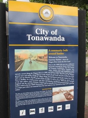
City of Tonawanda
A Community Built Around Lumber
Welcome to Tonawanda Gateway Harbor - where the Niagara River meets the Erie Canal.
Prior to the 1800's this area was a wilderness frequently traversed by Seneca Indians from the Iroquois Confederacy. The first known white settlers were Henry Anguish, who opened a tavern along the Niagara River in 1808, and Robert Simpson, who established a small general store and smithy along Ellicott Creek around the same time. The Erie Canal opened in 1825 and ran directly through the village along Tonawanda Creek and then along the Niagara River to Buffalo. As a result a colorful variety of shops and saloons opened up to service the needs of the lake sailors, canal boatmen and their families as well as the existing settlers from New England and the arriving Germans, Prussian and Alsatian immigrants. With the advent of the lumber trade in the late 1840's Tonawanda, with its naturally deep and protected harbor, emerged as a major port where raw material from the west made its way eastward to help build a growing nation.
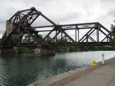
Jack-Knife Bridge.
This photo was taken looking east from the Delaware Street Bridge. The steel steam towboat and three steel barges at right were built initially as a wartime emergency fleet by the U.S. government. WWI was over before they appeared in the new Barge Canal, which, widened and deepened, replaced the old Erie Canal in the spring of 1918. Designed to fill a Barge Canal lock, the boats were put to good use hauling grain and other commodities eastward.
The cantilever-type bridge in the background was built in 1919 by the N.Y. Central Railroad. At that time, New York State had plans to rebuild all bridges along the canal to allow passage of vessels with masts. The idea was dropped, however, because of projected huge costs. This bridge was raised only a few times for testing and has never been raised since.
Erected by New York State Canals.
Topics and series. This historical marker is listed in these topic lists: Bridges & Viaducts • Native Americans • Settlements & Settlers • Waterways & Vessels. In addition, it is included in the Erie Canal series list. A significant historical year for this entry is 1808.
Location. 43° 1.31′ N, 78° 52.407′ W. Marker is in Tonawanda, New York, in Erie County. Marker is at the intersection of East Main Street and Longs Avenue, on the right when traveling west on East Main Street. Touch for map. Marker is in this post office area: Tonawanda NY 14150, United States of America. Touch for directions.
Other nearby markers. At least 8 other markers are within walking distance of this marker. The People (within shouting distance of this marker); Gastown (about 400 feet away, measured in a direct line); Long Homestead (about 700 feet away); a different marker also named The Long Homestead (about 700 feet away); First Schoolhouse (approx. 0.2 miles away); The Railroad (approx. 0.2 miles away); Lumber Port (approx. ¼ mile away); The Dam (approx. ¼ mile away). Touch for a list and map of all markers in Tonawanda.

Photographed By Anton Schwarzmueller, August 26, 2015
4. Jack-Knife Bridge
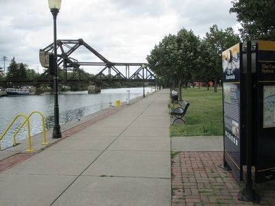
Owned by CSX, the tracks connect Niagara Falls (north) with Buffalo. The canal is Tonawanda Creek here and eastward to Pendleton where it turns north and into a made-made cut to Lockport. The canal/creek here is the Erie/Niagara county line.
Credits. This page was last revised on June 16, 2016. It was originally submitted on August 28, 2015, by Anton Schwarzmueller of Wilson, New York. This page has been viewed 771 times since then and 110 times this year. Photos: 1, 2, 3, 4. submitted on August 28, 2015, by Anton Schwarzmueller of Wilson, New York.


