Fredericksburg, Virginia — The American South (Mid-Atlantic)
Fredericksburg National Cemetery
The Battle of Fredericksburg
— Fredericksburg and Spotsylvania National Military Park —
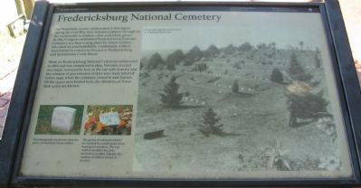
Approximately 20,000 soldiers died in this region during the Civil War, their remains scattered throughout the countryside in shallow, often unmarked, graves. In 1865 Congress established Fredericksburg National Cemetery as a final resting place for Union soldiers who died on area battlefields. Confederate soldiers were buried in cemeteries located at Fredericksburg and Spotsylvania Court House.
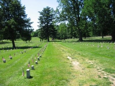
Work on Fredericksburg National Cemetery commenced in 1866 and was completed in 1869. Veterans erected two major monuments here in the late 19th century, and the remains of 300 veterans of later wars were interred before 1945, when the cemetery closed to new burials. Of the 15,300 men buried here, the identities of fewer than 3,000 are known.
Erected by National Park Service, U.S. Department of the Interior.
Topics and series. This historical marker is listed in these topic lists: Cemeteries & Burial Sites • War, US Civil. In addition, it is included in the National Cemeteries series list. A significant historical year for this entry is 1865.
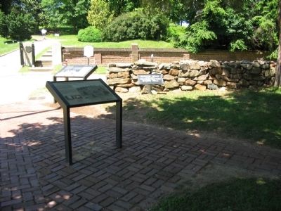
Location. 38° 17.608′ N, 77° 28.048′ W. Marker is in Fredericksburg, Virginia. Marker is on Lafayette Boulevard (State Highway 1) near Sunken Road, on the right when traveling west. Located at the south entrance to the Fredericksburg National Cemetery. Touch for map. Marker is in this post office area: Fredericksburg VA 22401, United States of America. Touch for directions.
Other nearby markers. At least 8 other markers are within walking distance of this marker. The Sunken Road (here, next to this marker); The Fifth Corps, Army of the Potomac (within shouting distance of this marker); A Winter Campaign Ends in Union Disaster (within shouting distance of this marker); Fredericksburg and Spotsylvania National Military Park (within shouting distance of this marker); A Segregated Park Service (within shouting distance of this marker); Fredericksburg Battlefield (about 300 feet away, measured in a direct line); 127th Regiment Pennsylvania Volunteer Infantry (about 300 feet away); a different marker also named Fredericksburg National Cemetery (about 400 feet away). Touch for a list and map of all markers in Fredericksburg.
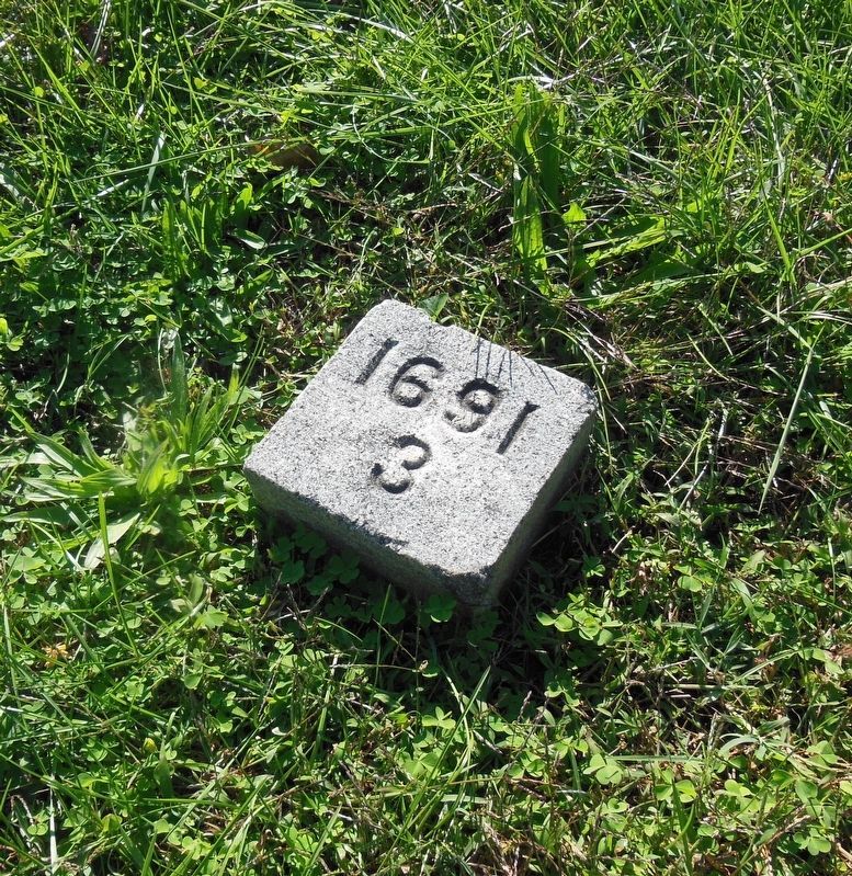
More about this marker. The main photo on the marker's right side shows Fredericksburg National Cemetery as it appeared about 1900. On the lower left are examples of the gravestones found in the cemetery. Rounded granite headstones mark the graves of identified Union soldiers. The graves of unknown soldiers are marked by a small square stone bearing two numbers. The top number identifies the plot; the bottom number identifies the number of soldiers buried in the plot.
This marker is duplicated at the north entrance to the cemetery.
Credits. This page was last revised on February 2, 2023. It was originally submitted on July 5, 2008, by Craig Swain of Leesburg, Virginia. This page has been viewed 1,689 times since then and 58 times this year. Photos: 1, 2, 3. submitted on July 5, 2008, by Craig Swain of Leesburg, Virginia. 4. submitted on February 15, 2021, by Bradley Owen of Morgantown, West Virginia.


