Mew in Russell County, Virginia — The American South (Mid-Atlantic)
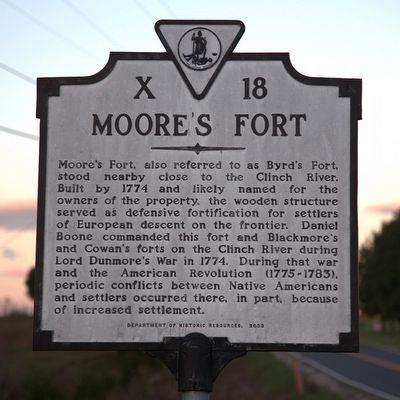
Moore’s Fort
Erected 2003 by Department of Historic Resources. (Marker Number X-18.)
Topics and series. This historical marker is listed in these topic lists: Forts and Castles • Native Americans • Settlements & Settlers • Wars, US Indian. In addition, it is included in the Virginia Department of Historic Resources (DHR), and the Virginia, Clinch River Forts Circa 1774 series lists. A significant historical year for this entry is 1774.
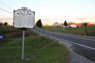
Location. 36° 51.734′ N, 82° 19.939′ W. Marker is in Mew, Virginia, in Russell County. Marker is on Mew Road (Virginia Route 65) just east of South Brutons Ford Road (County Route 611). Touch for map. Marker is in this post office area: Castlewood VA 24224, United States of America. Touch for directions.
Other nearby markers. At least 8 other markers are within 8 miles of this marker, measured as the crow flies. Veterans Memorial (approx. 3.1 miles away); Russell’s Fort (approx. 3.4 miles away); Dorton’s Fort (approx. 4.6 miles away); Old Russell County Courthouse (approx. 5.2 miles away); Early Settlers in Russell County (approx. 5½ miles away); Patrick Hagan and Dungannon (approx. 7.9 miles away); Flanary Archaeological Site (approx. 7.9 miles away); Dungannon Depot (approx. 7.9 miles away).
More about this marker. This marker replaces a marker with the same title and number that was located closer to St. Paul. That marker, erected around 1929, was located 1½ miles east of St. Paul, and was reported missing in Margaret Peter's 1985 Guidebook. The text read, “Near here, on Clinch River, stood Moore's Fort. Daniel Boone, on his way to Kentucky with a party of settlers, stopped here for some time. On September 29, 1774, Indians made an attack here from ambush, killing John Duncan.”
Also see . . . Wikipedia entry for Lord Dunmore’s War. “The conflict resulted from escalating violence between British colonists, who in accordance with previous treaties were exploring and moving into land south of the Ohio River (modern West Virginia, Southwestern Pennsylvania and Kentucky), and American Indians, who held treaty rights to hunt there. As a result of successive attacks by Indian hunting and war bands upon the settlers, war was declared "to pacify the hostile Indian war bands." The war ended soon after Virginia's victory in the Battle of Point Pleasant on October 10, 1774. As a result of this victory, the Indians lost the right to hunt in the area and agreed to recognize the Ohio River as the boundary between Indian lands and the British colonies.” (Submitted on October 21, 2015.)
Credits. This page was last revised on June 16, 2016. It was originally submitted on October 21, 2015, by J. J. Prats of Powell, Ohio. This page has been viewed 1,884 times since then and 227 times this year. Photos: 1, 2. submitted on October 21, 2015, by J. J. Prats of Powell, Ohio.

