Fort Myers in Lee County, Florida — The American South (South Atlantic)
Edison Pier
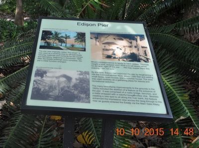
The pier was originally called “the wharf.” It was used as a working area to off-load boats carrying materials and contents for the homes and laboratory, beginning in November 1885. After the Estate buildings were complete, the pier’s initial function changed.
Mina’s correspondence to family in 1909 relates, “Thomas caught a trout, snapper and I think a small tarpon which he did land, right off the pier… We may supper there this evening, I am not sure.”
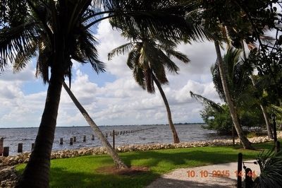
By this time, Edison had improved the pier by lengthening it into the Caloosahatchee River about 1,500 feet and adding small docks, boat houses, and a summer house. The area was used routinely as a gathering place for leisure and recreational actives.
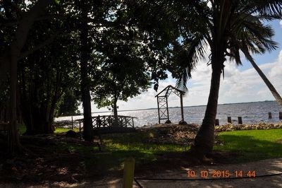
The many beautifying improvements to the grounds in the 1920s included the addition of a feature at the entrance of the pier. It was comprised of a rustic bridge, benches, and a trellis wrapped with a colorful bougainvillea vine. Besides creating a new spot to sit along the river bank, the feature enhanced the impressive view across the lawn through to the river as guest entered the Estate via the Main Gate Allee.
(captions)
A postcard of the Edison historic pier. (Circa 1930)
Mina strolls across the bridge. (Circa 1925)
Mina Edison and a friend at the summer house on the Edison pier. (Circa 1920)
Topics. This historical marker is listed in these topic lists: Animals • Arts, Letters, Music • Waterways & Vessels. A significant historical month for this entry is November 1885.
Location. 26° 38.067′ N, 81° 52.804′ W. Marker is in Fort Myers, Florida, in Lee County. Marker can be reached from McGregor Boulevard south of Larchmont Avenue, on the right when traveling south. The marker is inside the Edison & Ford Winter Estates. Touch for map. Marker is at or near this postal address: 2350 McGregor Blvd, Fort Myers FL 33901, United States of America. Touch for directions.
Other nearby markers. At least 8 other markers are within walking distance of this marker. Edison Estate Restoration and Rebirth (here, next to this marker); Orchid Lane and Friendship Walk (here, next to this marker); Clara Ford’s Michigan Rose Garden (here, next to this marker); Edison’s “Florida Paradise” (here, next to this marker); Inside the Ford Home (here, next to this marker); Henry Ford (here, next to this marker); Henry Ford's Florida Estate (here, next to this marker); Edison Caretaker’s House (here, next to this marker). Touch for a list and map of all markers in Fort Myers.
Also see . . . Edison & Ford Winter Estates. (Submitted on November 6, 2015.)
Credits. This page was last revised on August 18, 2020. It was originally submitted on November 5, 2015, by Sandra Hughes Tidwell of Killen, Alabama, USA. This page has been viewed 290 times since then and 22 times this year. Photos: 1, 2, 3. submitted on November 5, 2015, by Sandra Hughes Tidwell of Killen, Alabama, USA. • Bernard Fisher was the editor who published this page.


