Colonia Tlatelolco in Ciudad de México, Mexico — The Valley of Mexico (The Central Highlands)
Tlatelolco: a well-planned city
Tlatelolco: una ciudad bien planeada
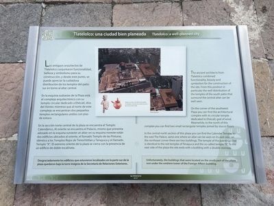
Los antiguos arquitectos de Tlatelolco conjuntaron funcionalidad, belleza y simbolismo para su construcción, y desde este punto, se puede apreciar la cuidadosa distribución de los templos del patio sur en torno al altar central.
En la esquina sudoeste de la Plaza está el complejo arquitectónico con su templo circular dedicado a Ehécatl, dios del Viento; mientras que al norte de este complejo se encuentran dos pequeños templos rectangulares unidos con piso de estuco.
En la sección norte central de la plaza se encuentra el Templo Calendárico, Al oriente se encuentra el Palacio mismo que presenta adosado en la esquina suroeste un altar; en su esquina noreste están dos edificios ubicados al oriente, el llamado Templo de las Pinturas, idéntico a los Templos Rojos de Tenochtitlan y Tenayuca y el llamado Templo “X”. El extremo oriente de la plaza se cierra con la presencia de un edificio de doble escalinata.
Desgraciadamente los edificios que estuvieron localizados en la parte sur de la plaza quedaron bajo la torre insignia de la Secretaría de Relaciones Exteriores.
Pie de dibujo:
Vasija con asa y escultura de piedra localizadas durante las exploraciones de la torre de la SRE.
Acercamiento
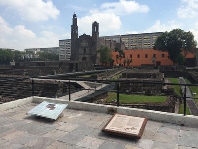
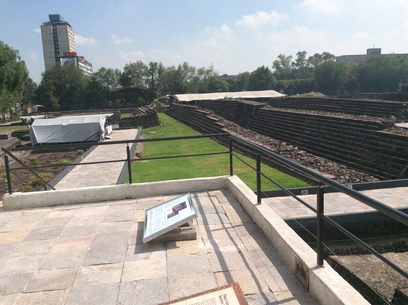
The ancient architects from Tlatelolco combined functionality, beauty and symbolism for the construction of the site. From this position in particular the well distribution of the temples of the south patio that surround the central altar can be well seen.
On the corner of the southwest Plaza you can find the architectural complex with its circular temple dedicated to Ehécatl, god of wind. Meanwhile, to the north of this complex you can find two small rectangular temples joined by stucco floors.
In the central north section of this plaza you can find the Calendar Temple, to the east The Palace, same one where an altar can be seen on its east side; on the northeast corner there are two buildings, The temple of the paintings that is identical to the red temples of Tenayuca and the so called temple “X”. To the east side of the plaza the site ends with a building with a double stairway.
Unfortunately, the buildings that were located on the south part of the plaza rest under the emblem tower of the Foreign Affairs building.
English translation of the captions:
A clay jar with a handle and a stone sculpture found during the exploration of the Foreign Affairs tower.
Close-up photograph.
Topics.
This historical marker is listed in these topic lists: Anthropology & Archaeology • Man-Made Features.
Location. 19° 27.051′ N, 99° 8.282′ W. Marker is in Ciudad de México. It is in Colonia Tlatelolco. The marker is at the Tlatelolco Archeological Site on Eje Central near the intersection with Avenida Ricardo Flores Magón. Touch for map. Marker is in this post office area: Ciudad de México 06900, Mexico. Touch for directions.
Other nearby markers. At least 8 other markers are within walking distance of this marker. The Southern Plaza of the Sanctuary (here, next to this marker); The Tlatelolco Lovers (a few steps from this marker); Superimposed altars (within shouting distance of this marker); Ehécatl Quetzalcóatl: attracting rain and fertility (within shouting distance of this marker); Tzompantli altar (“flag of heads”) of the south. (within shouting distance of this marker); El Temazcal (within shouting distance of this marker); Between the past and the modern times (within shouting distance of this marker); The Calendar Temple (within shouting distance of this marker). Touch for a list and map of all markers in Ciudad de México.
Credits. This page was last revised on April 17, 2020. It was originally submitted on January 4, 2016, by J. Makali Bruton of Accra, Ghana. This page has been viewed 288 times since then and 7 times this year. Photos: 1, 2. submitted on January 4, 2016, by J. Makali Bruton of Accra, Ghana. 3. submitted on August 12, 2017, by J. Makali Bruton of Accra, Ghana.


