Near Gulf Shores in Baldwin County, Alabama — The American South (East South Central)
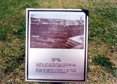
The Citadel
(1821-1865)
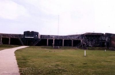
During the Union bombardment of Fort Morgan on August 22nd, 1864 the Citadel roof caught fire and burned out of control. Following the Civil War the structureís gutted ruins were demolished.
Topics. This historical marker is listed in these topic lists: Forts and Castles • War, US Civil. A significant historical date for this entry is August 22, 1864.
Location. 30° 13.711′ N, 88° 1.366′ W. Marker is near Gulf Shores, Alabama, in Baldwin County. Marker can be reached from Fort Morgan Road (Alabama Route 180) 1.7 miles west of Dune Drive when traveling west. Located in Fort Morgan State Historic Park. Touch for map. Marker is at or near this postal address: 51 Highway 180 West, Gulf Shores AL 36542, United States of America. Touch for directions.
Other nearby markers. At least 8 other markers are within walking distance of this marker. Citadel (1825-1865) (a few steps from this marker); The Battle of Mobile Bay (within shouting distance of this marker); a different marker also named The Battle of Mobile Bay (within shouting distance of this marker); 6.4Ē (100 pounder) Parrott Rifle / 7Ē Brooke Rifle (within shouting distance of this marker); a different marker also named The Battle of Mobile Bay (within shouting distance of this marker); Panama Mount (about 300 feet away, measured in a direct line); Battery Thomas (1898-1917) (about 300 feet away); The Pride of Seven Flags (about 300 feet away). Touch for a list and map of all markers in Gulf Shores.
Credits. This page was last revised on June 16, 2016. It was originally submitted on March 12, 2016, by Don Morfe of Baltimore, Maryland. This page has been viewed 832 times since then and 55 times this year. Photos: 1, 2, 3, 4, 5, 6. submitted on March 12, 2016, by Don Morfe of Baltimore, Maryland. • Bernard Fisher was the editor who published this page.
