Near Clayton in Contra Costa County, California — The American West (Pacific Coastal)
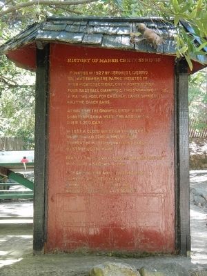
History of Marsh Creek Springs
At one time the grounds entertained 5,000 people on a week end arriving in over 1,200 cars.
In 1957 a cloudburst on the east side of Mt. Diablo sent a twelve foot torrent of water down Marsh Creek destroying the park.
Rebuilt that year - it was again destroyed in 1962 by a second - flood.
In 1964 the John and Eloise McHugh family purchased the area, known as section number one, and began restoring its beauty.
Topics. This historical marker is listed in these topic lists: Entertainment • Natural Features • Waterways & Vessels.
Location. 37° 53.524′ N, 121° 51.103′ W. Marker is near Clayton, California, in Contra Costa County. Marker can be reached from Marsh Creek Road near Aspara Drive. Touch for map. Marker is at or near this postal address: 12510 Marsh Creek Road, Clayton CA 94517, United States of America. Touch for directions.
Other nearby markers. At least 8 other markers are within 5 miles of this marker, measured as the crow flies. Old Marsh Creek Springs (within shouting distance of this marker); Mount Diablo (approx. 3˝ miles away); Mount Diablo Beacon: (approx. 3˝ miles away); Mt Diablo State Park (approx. 3˝ miles away); What Are Those Towers For? (approx. 3.7 miles away); Mount Diablo State Park (approx. 3.7 miles away); Eureka Slope (approx. 4.4 miles away); Mount Diablo Coal Field (approx. 4.4 miles away).
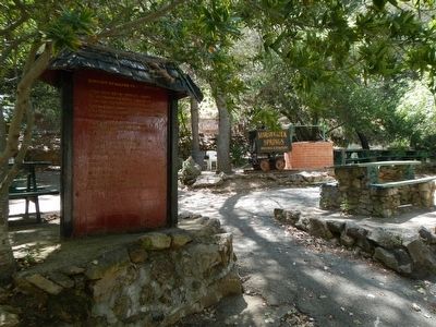
More about this marker. This marker is across the foot bridge in the picnic ground on the east side of Marsh Creek.
Credits. This page was last revised on June 16, 2016. It was originally submitted on May 16, 2016, by Barry Swackhamer of Brentwood, California. This page has been viewed 1,320 times since then and 81 times this year. Photos: 1, 2. submitted on May 16, 2016, by Barry Swackhamer of Brentwood, California.

