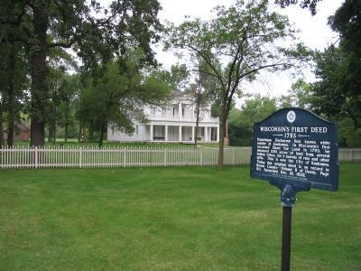
On Augustine Street east of Terry Lane, on the left when traveling east.
Dominique Ducharme first known white settler at Kaukauna. In Wisconsin’s first recorded Deed For Land in 1793, he obtained 1281 acres of land from several Indian tribes, for 2 barrels of rum and other gifts. This is now the City of Kaukauna. Today . . . — — Map (db m4239) HM
On Bay Settlement Road north of VanLaanen Road, on the right when traveling north.
Why Was This Project Undertaken?
WIS 57 is the primary route into and out of the Door Peninsula's popular resort country and by the early 1990s had become inadequate to safely carry current traffic loads.
A Wisconsin Department of . . . — — Map (db m143303) HM
is a vital part of our local economy, our history and our lives. It plays an important role in the transportation of goods and commodities that are critical to the economic health of the region. The Port of Green Bay receives and/or sends . . . — — Map (db m43817) HM
On County Road DK east of County Road N, on the left when traveling east.
Why Was This Project Undertaken?
WIS 57 is the primary route into and out of the Door Peninsula's popular resort country and by the early 1990s had become inadequate to safely carry current traffic loads.
A Wisconsin . . . — — Map (db m80274) HM
On Cottonwood Street 0.2 miles west of South Broadway Street (Minnesota Highway 15 / 68), on the right when traveling west.
Christian Adam(s) was born circa 1812 in Prussia. He sailed from LeHavre, France aboard the ship Pactolus which arrived in New York City October 12, 1846. The passenger manifest listed his occupation as farmer.
Petronella Keller Adam(s) was . . . — — Map (db m73759) HM
On G at B (County Route B), on the right when traveling west on G.
The Land
First Capitol Historic Site is located in the Driftless Area of southwestern Wisconsin. When the glaciers bypassed the area they left the soft sandstones and limestones intact to form the varied landscape you see today. Belmont Mound . . . — — Map (db m33277) HM
On East Walnut Street at South Jefferson Street, on the left when traveling west on East Walnut Street.
This statue, designed by Suamico native, Sydney Bedore, and dedicated on June 10, 1931 with Governor Phillip Lafollette among the speakers, represents a Fox Indian, Claude Allouez and Nicholas Perrot. Native Americans lived in Wisconsin for about . . . — — Map (db m39250) HM
Near South Monroe Avenue (State Highway 57) 0.1 miles north of Emilie Street, on the left when traveling north.
of the Morgan L. Martin family for 100 years (1837-1937). Martin was a prominent Green Bay attorney, civic leader, Indian agent and entrepreneur, originally from upstate New York, who helped lay the foundation for Wisconsin's statehood. In 1848, . . . — — Map (db m37204) HM
The Roi-Porlier-Tank Cottage… has an extraordinary rich history in Green Bay, as it was home to a fur trader, schoolmaster, judge and missionary.
In 1803, a French Canadian fur trader by the name of Joseph Roi built the small cottage . . . — — Map (db m241106) HM
Near County Road 11 1.1 miles north of County Road 6, on the left when traveling north.
The Sioux Indians called this lake "minne hanska," meaning "long water." The basin of the lake was formed 11,000 to 15,000 years ago by the Wisconsin glacier; the original hard clay bottom is now about 50 feet below the present surface of the . . . — — Map (db m66454) HM
Thin black lines indicate changes in relevance. Between each pair of lines entries are ordered geographically but all have the same relevance.
* Inflectional forms of words are their plurals, singulars, and possessives as well as gramatical tenses and similar variations.