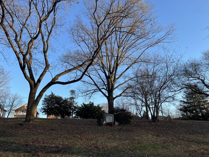
On Forest Avenue west of Duer Lane, on the right when traveling east.
Erected on the 150th anniversary of the American Revolution by the Polish American Citizens of Richmond Co. N.Y. to the memory of
General Tadeus Kosciuszko
and
General Kazimierz Pulaski
as a token of their loyalty to the cause of . . . — — Map (db m239464) WM
On Cobbham Road (State Road 150), on the right when traveling west.
On this site stood the home of William Few, one of Georgia's signers of the United States Constitution. Built in 1781, the house burned in 1930.
William Few was born near Baltimore, Maryland, June 8, 1748. In 1776 he moved to Augusta, . . . — — Map (db m27053) HM
On Tysen Court just south of Center Street, on the right when traveling north.
For nearly a century, the Richmond County Jail stood behind the Third County Courthouse, where the parking lot is now located. The first jail in this location was a fortress-style structure built in 1860. By the 1890s, conditions in the jail were . . . — — Map (db m181546) HM
On Jefferson Street at Seaver Avenue, on the right when traveling north on Jefferson Street.
What was here before?
The land encompassing this park and the General Charles W. Berry Houses was once occupied by the Richmond County Fair Grounds. In 1905 the Richmond County Fair moved to the fairgrounds, after it was previously held in . . . — — Map (db m271295) HM
On Richmond Terrace west of Van Name Avenue, on the right when traveling west.
1776
Adapted detail of "A plan of New York Island, with part of Long Island, Staten Island & east New Jersey, with a particular description of the engagement on the Woody heights of Long Island, between Flatbush and Brooklyn, on the 27th of . . . — — Map (db m271321) HM
On Jewett Avenue north of Castleton AVenue, on the right when traveling north.
This park is named in honor of Abraham Levy (1890-1917), the first serviceman from Richmond County to die in World War I. Levy lived at 1166 Castleton Avenue in West New Brighton, Staten Island. As a 2nd Class Seaman in the Naval Reserve, Levy . . . — — Map (db m271315) HM
On Bayonne Bridge (New York State Route 440) north of Trantor Place, on the right when traveling north.
Long before the City of Bayonne and Richmond County (Staten Island) were fully developed, they were destinations of leisure and recreation for New York City residents. People came by the thousands from the crowded city to fish, hunt, bathe, sail, . . . — — Map (db m271334) HM
Near Seguine Avenue east of Hank Place, on the right when traveling east. Reported permanently removed.
A stately Greek Revival structure, the Seguine House faces Prince’s Bay on the southern shore of Staten Island. Built in 1838 by Joseph H. Seguine (1801-1856), the house is a physical reminder of the classical architecture and thriving commerce of . . . — — Map (db m155032) HM
On Route 9 Bike Path 0.7 miles north of Leetown Road (County Road 1), on the right when traveling south.
Traveller's Rest
Traveller's Rest is the site of a pre-Revolutionary War, 1½-story limestone dwelling and several log, wood frame, and masonry outbuildings. The property is listed in the National Register of Historic Places and . . . — — Map (db m150614) HM
Near Constitution Avenue Northwest (U.S. 50) east of 19th Street Northwest, on the right when traveling east.
In Congress, July 4, 1776.Unanimous Declaration of the thirteen united States of America.And for the support of this Declaration,
with a firm reliance on the protection of Divine Providence,
we . . . — — Map (db m137039) HM
Thin black lines indicate changes in relevance. Between each pair of lines entries are ordered geographically but all have the same relevance.
* Inflectional forms of words are their plurals, singulars, and possessives as well as gramatical tenses and similar variations.