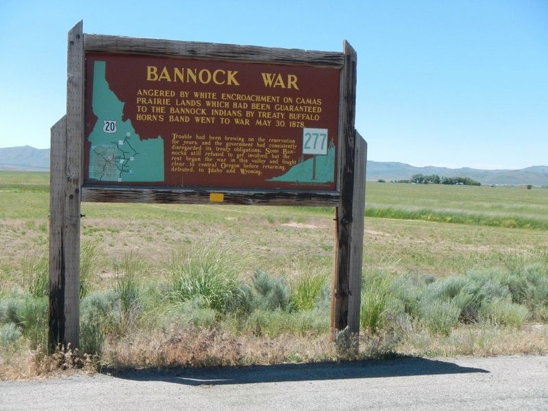
On U.S. 20 at milepost 148 near Washington/Wheat Ranch Road, on the left when traveling west.
Angered by white encroachment on Camas Prairie lands which had been guaranteed to the Bannock Indians by treaty, Buffalo Horn's band went to war May 30, 1878
Trouble had been brewing on the reservation for years, and the government had . . . — — Map (db m110141) HM
On Westgate (Northwest Pendleton Highway) (U.S. 30) near County Route 1302, on the left when traveling west.
Weary emigrants traveling westward on the Oregon Trail favored a campsite on the near bank of the Umatilla River at this point. On leaving they climbed the same hill the highway now traverses. Then recrossed the Umatilla River at Echo 20 hot dusty . . . — — Map (db m111912) HM
On Pendleton-John Day Highway (U.S. 395), on the right when traveling south.
The decisive engagement of the Bannock War was fought on the foothills of Battle Mountain, July 8, 1878. The war - a protest against white encroachment, and the last major uprising in the Pacific Northwest-was started by Bannock Indians, but Egan, a . . . — — Map (db m96868) WM
On South Main Street (U.S. 30) at SW Emigrant Avenue, on the left when traveling north on South Main Street.
In 1943, The African-American 555th Parachute Infantry Battalion was formed. The “Triple Nickles” -as they spelled it- were the first black paratroopers in the segregated US Army during World War II.
In 1944- 1945, Japan launched incendiary . . . — — Map (db m191579) HM
On Southwest Frazer Avenue near Southwest 1st Street.
In 1879 Maria Byrd, a widow, donated the land for Umatilla County School District #21. The school was located 6.1 miles south of Pilot Rock, near the junction of West Birch Creek and the Yellow Jacket Road. Maria and her husband, Daniel Byrd, . . . — — Map (db m111598) HM
On North Main Street near Northwest Bailey Avenue, on the right when traveling north.
Currently used as the Pendleton Center for the Arts, this structure was built with $25,000 of endowment money from the Carnegie Foundation plus funds from the County for use as the Umatilla County Library. The architect was Folger Johnson of . . . — — Map (db m111853) HM
On Southwest Frazer Avenue near Southwest 1st Street, on the left when traveling west.
The existing Depot building was built in 1909 by the Oregon Railway and Navigation Company. The depot building is primarily styled after architecture of the Mediterranean, as seen in the tiled hip roof, decorative roof support brackets and brick . . . — — Map (db m111599) HM
On South Main Street near Southeast Court Avenue, on the left when traveling north.
The Milarkey Building at 203 South Main Street is 26 ft. by 100 ft. long and was erected in 1883-84 by Thomas Milarkey in the "Late Simple Expression Italianate" style. This style is typical of many brick commercial buildings constructed in . . . — — Map (db m111772) HM
Thin black lines indicate changes in relevance. Between each pair of lines entries are ordered geographically but all have the same relevance.
* Inflectional forms of words are their plurals, singulars, and possessives as well as gramatical tenses and similar variations.