Near Old Floral City Road, 0.2 miles south of Carnegie Drive, on the right when traveling south.
Setting the Scene In the Spring of 1836, President Andrew Jackson ordered General Winfield Scott, commander of the U.S. Army in Florida, to punish and defeat the belligerent Seminoles. Gen. Scott devised a complicated plan in which three . . . — — Map (db m132055) HM
Near Old Floral City Road, 0.2 miles south of Carnegie Drive, on the right when traveling south.
Prior to the Spanish arrival in the 1500s, there were hundreds of thousands of Native Americans living in Florida. Evidence of their diverse culture has been discovered in the mounds, earthworks, middens and other archaeological sites found . . . — — Map (db m132271) HM
Near Old Floral City Road, 0.2 miles south of Carnegie Drive, on the right when traveling south.
Seminole Migration Story of Survival The Seminole are descendants of the Muscogee group consisting primarily of Creek Indians from Georgia and Alabama. In the early 1700s, various bands of Creeks and other Muskogean peoples began to migrate . . . — — Map (db m132273) HM
Near Old Floral City Road, 0.2 miles south of Carnegie Drive, on the right when traveling south.
Adapting to Life in the Cove Necessities of Life Before the Seminole were forced to move to the Cove, they were farmers and ranchers who lived in sturdy log homes and based their wealth on large herds of cattle and extensive crops. Unlike the . . . — — Map (db m132276) HM
Near Old Floral City Road, 0.2 miles south of Carnegie Drive, on the right when traveling south.
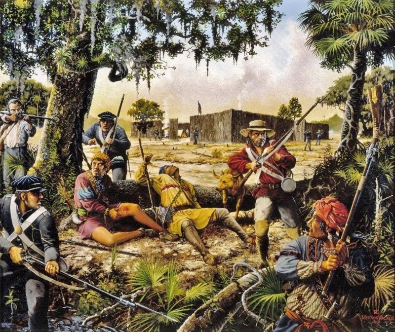
The Second Seminole War BeginsA Year of Victory for the Seminole In the early 1830s pressure to remove Florida's Indians grew intense. Seminole leaders signed treaties in 1832 and 1833 that called for the tribe to relocate within three . . . — — Map (db m132277) HM
Near Old Floral City Road, 0.2 miles south of Carnegie Drive, on the right when traveling south.
The Siege of Fort CooperA Hastily Built Defense In March 1836, General Winfield Scott launched a campaign to surround the Seminole in the Cove with an army of approximately 5,000 men. While marching to Fort Brooke in Tampa they stopped . . . — — Map (db m132281) HM
Near South Florida Avenue (U.S. 41) 0.5 miles north of East Fort Cooper Road, on the right when traveling north.
More than 1,500 soldiers died and $20 million was spent in the Second Seminole War. It was the most costly of three conflicts between the U.S. and the Seminoles in Florida. Fought from 1835–1842, the war broke out when Seminoles resisted . . . — — Map (db m101818) HM
On South Old Floral City Road, 0.2 miles south of Carnegie Drive, on the right when traveling south.
Fort Cooper was constructed in April 1836 during the Second Seminole War. General Winfield Scott instructed the First Georgia Battalion of Volunteers under the leadership of Major Mark Anthony Cooper to build two bastions and a blockhouse on the . . . — — Map (db m93258) HM