THE HISTORICAL
MARKER DATABASE
“Bite-Size Bits of Local, National, and Global History”


10 entries match your criteria.  


Related Historical Markers

Tour the markers in the vicinity of Bunker Hill.
 
By Bill Coughlin, April 15, 2009
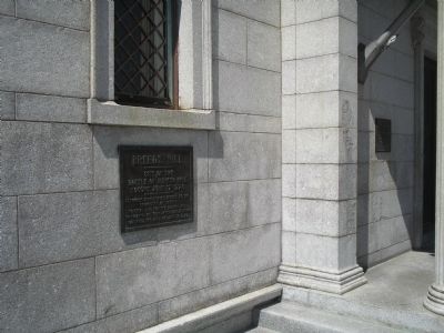
Marker at Bunker Hill
SHOWN IN SOURCE-SPECIFIED ORDER
1 ► Massachusetts, Suffolk County, Boston, Charlestown — Breed’s Hill —
Near Monument Square.
--------------- Site of the Battle of Bunker Hill fought June 17, 1775 --------------- Although orders were issued by the Committee of Safety to seize and fortify Bunker Hill the colonial officers after consultation fortified this hill on June 16, . . . — — Map (db m17974) HM
2 ► Massachusetts, Suffolk County, Boston, Charlestown — Bunker Hill Monument —
Near Monument Square, on the left when traveling north.
“Don’t fire ‘til you see the whites of their eyes.”
The Battle of Bunker Hill, fought here on Breed’s Hill, June 17, 1775, was the first major military confrontation of the Revolutionary War. Although the . . . — — Map (db m282107) HM
3 ► Massachusetts, Suffolk County, Boston, Charlestown — North-East Corner of the Redoubt —
Near Monument Sq.
North-East Corner of the Redoubt thrown up on the night of the sixteenth of June 1775 — — Map (db m18656) HM
4 ► Massachusetts, Suffolk County, Boston, Charlestown — South-East Corner of the Redoubt —
Near Monument Square 0 miles north of Monument Avenue, on the left.
South-East Corner of the Redoubt Thrown up on the Night of the Sixteenth of June 1775 — — Map (db m21412) HM
5 ► Massachusetts, Suffolk County, Boston, Charlestown — The Breastwork —
Near Monument Square.
The Breastwork thrown up on the morning of the seventeenth of June 1775 extended northerly three hundred feet — — Map (db m18658) HM
6 ► Massachusetts, Suffolk County, Boston, Charlestown — The Rail Fence and Grass Line —
Near Monument Square.
The rail fence and grass line of protection formed after the British troops landed was six hundred feet in the rear at the base of Bunker Hill — — Map (db m18659) HM
7 ► Massachusetts, Suffolk County, Boston, Charlestown — Massachusetts Gate —
On Monument Sq at Monument Ave on Monument Sq.
Colonel William Prescott of Massachusetts led the colonial forces on Breed’s Hill. His commanding figure and strong will inspired the farmer soldiers to the greatness of the day. Dr. Joseph Warren, commissioned a Major General, elected to serve . . . — — Map (db m18651) HM
8 ► Massachusetts, Suffolk County, Boston, Charlestown — Connecticut Gate —
On Monument Square at Chestnut St. on Monument Square.
June 17, 1775 He who brought us over still sustains us. Connecticut American Revolution Bicentennial Commission South Marker: General Israel Putnam of Connecticut helped decide to fortify the Charlestown peninsula and with Captain Thomas . . . — — Map (db m191806) HM
Paid Advertisement
9 ► Massachusetts, Suffolk County, Boston, Charlestown — New Hampshire Gate —
On Monument Sq at Monument St on Monument Sq.
June 17, 1775 Strength United is Stronger New Hampshire American Revolution Bicentennial Commission East Marker: Colonel John Stark commanded 900 New Hampshire men at the rail fence and at the stone wall on the Mystic River shore against the . . . — — Map (db m115949) HM
10 ► Massachusetts, Suffolk County, Boston, Charlestown — United States Gate — 1775 ----- 1975 —
On Monument Sq at Monument Sq on Monument Sq.
On this hill the Continental militia fought heroically on June 17, 1775. Protected by an earth and timber redoubt laid out by Colonel Richard Gridley, the Army’s first chief engineer, the Americans killed or wounded nearly half of the attacking . . . — — Map (db m18653) HM
 
 
CeraNet Cloud Computing sponsors the Historical Marker Database.
This website earns income from purchases you make after using our links to Amazon.com. We appreciate your support.
Paid Advertisement
Oct. 12, 2026
