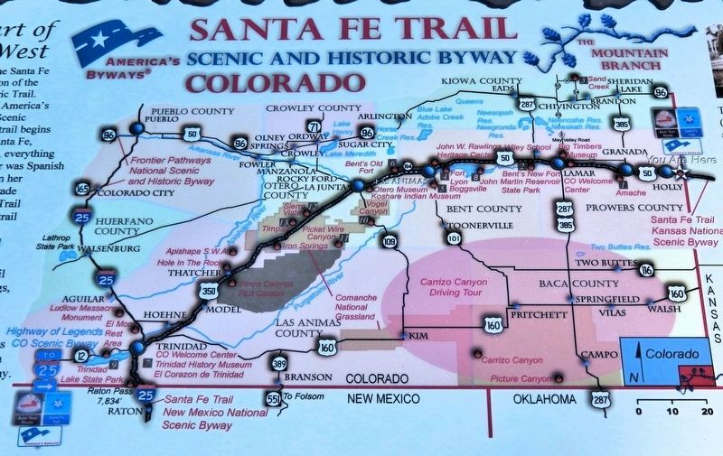
Near Santa Fe Trail Scenic Byway (U.S. 50/400 at milepost 467.4), 0.5 miles west of the Colorado/Kansas state border, on the left when traveling west.
The Heart of the Old West Colorado's portion of the Santa Fe Trail is a 184-mile section of the Santa Fe National Historic Trail. It is designated as one of America's Byways and a Colorado Scenic and Historic Byway. The trail begins in Missouri . . . — — Map (db m289642) HM
Near Santa Fe Trail Scenic Byway (U.S. 50/400 at milepost 467.4), 0.5 miles west of the Colorado/Kansas state border, on the left when traveling west.
From cattle kings to cowboys and cow towns to hell on wheels railroad camps, this portion of the Santa Fe Trail encompasses all of the legends of America's Old West. Hiram S. Holly, town founder, arrived here in 1871 with 1,300 cattle. His 50,000 . . . — — Map (db m289600) HM