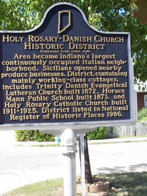
On South East Street at South Stevens Street on South East Street.
Platted 1854; now bounded by South East Street, Virginia Avenue, and interstates 65/70. Early residents were Germans, Irish, Scots, and Welsh. Danes resided in area circa 1870–1890. By 1910, ninety percent of area residents were Italian . . . — — Map (db m1839) HM
On South East Street at Virginia Avenue, on the left when traveling south on South East Street. Reported damaged.
German, Irish, Scottish, Danish, and Welsh immigrants moved to this neighborhood starting in the mid-1800s. In the 1890s, Italian families who made their livings selling fruit and vegetables, particularly Sicilians, began to settle in the . . . — — Map (db m303438) HM
On Virginia Avenue just north of East McCarty Street, on the left when traveling north. Reported damaged.
German, Irish, Scottish, Danish, and Welsh immigrants moved to this neighborhood starting in the mid-1800s. In the 1890s, Italian families who made their livings selling fruit and vegetables, particularly Sicilians, began to settle in the . . . — — Map (db m303441) HM