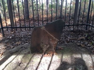
On U.S. 43 at milepost 19, 0.1 miles south of Lofton Road, on the right when traveling north.
Marks 1st Southern Boundary of the United States and the Mississippi Territory created in 1798
-----900 feet East-----
Stone marked 31° North Latitude separating the U.S. & Spanish Florida.
This line of demarcation ran from the . . . — — Map (db m104073) HM
On N. Prince Street, on the left when traveling south.
Surveyor, mathematician, astronomer. Secretary, Pennsylvania Land Office, 1801-08. In 1803, while living here, he taught Meriwether Lewis surveying and navigation skills. Helped survey & draw boundaries of New York, Pennsylvania, Washington, D.C. & . . . — — Map (db m5171) HM