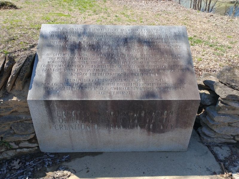
On Wilkinson Boulevard, on the right when traveling south.
Between 1776 and 1780 Kentucky was a single county of the
commonwealth of Virginia. In 1780 the Virginia legislature divided
Kentucky County into three smaller counties–Fayette, Jefferson
and Lincoln. These became Kentucky's first three counties . . . — — Map (db m194233) HM
On South Tulane Avenue, on the right when traveling south.
With the threat of war looming, Anderson County residents voted overwhelmingly against secession in 1861. When Confederate forces occupied East Tennessee and established a conscription center at nearby Clinton, Unionists slipped into Kentucky to . . . — — Map (db m112103) HM
On Cream Level Road 1.5 miles north of Edmonson Ave, on the right when traveling north.
According to family history, Thomas Boucher Wood (1820-1897) was born in Columbus, Mississippi. He attended the University of Louisville in Kentucky in 1843 and again in 1849, at which time he received his doctoral degree in medicine with a thesis . . . — — Map (db m310456) HM
On Norris Freeway (U.S. 441) 0.1 miles south of Clear Creek Road, on the left when traveling south.
Divided loyalties in Anderson County, as elsewhere in East Tennessee, often erupted in violence. It was commonplace for guerillas on both sides to raid farms and capture opposing sympathizers. In the county seat of Clinton, Confederates . . . — — Map (db m119021) HM
Thin black lines indicate changes in relevance. Between each pair of lines entries are ordered geographically but all have the same relevance.
* Inflectional forms of words are their plurals, singulars, and possessives as well as gramatical tenses and similar variations.