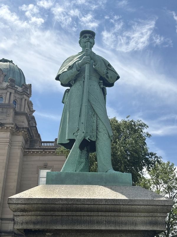
On Court Street (Illinois Route 17) east of Indiana Avenue ( Route 50), on the right when traveling east.
In memory of the soldiers of Kankakee County who fought for the Union.
1861-1865
Love of country is a nation's strongest safeguard. — — Map (db m301627) WM
On Main Street Northwest (Illinois Route 102) at South Main Street (U.S. 52), on the right when traveling east on Main Street Northwest.
[left panel] Darkness engulfed the frozen landscape of the northern edge of Bourbonnais on the evening of Monday, March 15, 1999, when the Amtrak train, the City of New Orleans, heading south from Chicago, collided at the McKnight . . . — — Map (db m177502) HM
Madison Gregory was born in Huron County, Ohio in 1848. He married Ester Randall on December 26, 1870 in Kankakee County, Illinois. Three daughters were born to them in Kankakee County-Lillie Gregory Martin, Jennie Gregory, and Ethel Gregory . . . — — Map (db m125356) HM
On Western Avenue north of York Street, on the left when traveling south.
Blue Island sits atop a 6-mile long glacial ridge, left behind 14,000 years ago when the 5000-foot thick Laurentide ice sheet melted and retreated, also scraping out the basin of Lake Michigan, to a depth of 340 feet below sea level.
In . . . — — Map (db m297904) HM
On 8th Avenue near Water Street, on the right when traveling south.
This building was erected with funds provided by the people of the State of Illinois in memory of Governor Len Small
Under his leadership, from 1921 to 1929 Illinois led the nation in constructing over 8000 miles of hard roads — — Map (db m301582) HM
On 8th Avenue near Water Street, on the right when traveling south.
As governor of the State of Illinois from 1921 to 1929 Len Small was known as the "Good Roads Governor," for the Illinois Waterway Project, for an expanding public welfare program, and for his extensive interests in agriculture. — — Map (db m301583) HM
Near Croswell Avenue north of Perry Street, on the left when traveling east.
Thomas Durham bought 160 acres on this site in 1835 from Gurdon S. Hubbard. Known as the Jonveau Reserve, the land lay in an area called Bourbonnais Grove. Durham opened 20 acres for cultivation. In January 1836, parts of Cook and Iroquois Counties . . . — — Map (db m105729) HM
On Court Street (Illinois Route 17) near Indiana Avenue ( Route 50), on the right when traveling east.
Fourscore and seven years ago our fathers brought forth on this continent a new nation, conceived in liberty, and dedicated to the proposition that all men are created equal.
Now we are engaged in a great Civil War, testing whether that nation, . . . — — Map (db m301678) HM
Thin black lines indicate changes in relevance. Between each pair of lines entries are ordered geographically but all have the same relevance.
* Inflectional forms of words are their plurals, singulars, and possessives as well as gramatical tenses and similar variations.