Blue Island in Cook County, Illinois — The American Midwest (Great Lakes)
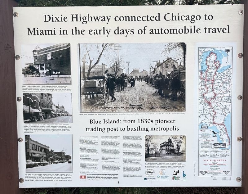
Dixie Highway connected Chicago to Miami in the early days of automobile travel
Blue Island: from 1830s pioneer trading post to bustling metropolis
Photographed by Sean P. Flynn, April 19, 2026
1. Dixie Highway connected Chicago to Miami in the early days of automobile travel Marker
In prehistoric times, Lake Michigan's shoreline was at the Blue Island ridge, then receded eastward to the Michigan Avenue ridge in Roseland, and finally to its present shoreline. Blue Island was truly an island then, surrounded by water 60 feet higher than today.
Prevailing winds, wave action and currents formed sand on the lee side of the island, which is now home to Mt. Olivet and Mt. Greenwood cemeteries, as well as Ridge and Beverly Country Club, which show the subtle highs and lows of sand dune terrain. Gravediggers of old preferred the dry, yielding, well-drained soil.
Why is it named Blue Island?
Pioneers traveling from the east steered covered wagons around the southern tip of Lake Michigan and encountered a heavily-timbered ridge that rose abruptly 40 to 50 feet above the surrounding land. When viewed from a distance, the ridge appeared to be enshrouded by an azure vapor,
this page online
In 1834 Thomas Courtney built a log cabin overlooking Stony Creek at what is now Grove and Ann streets, later the site of the First Lutheran Church of Blue Island. German immigrants founded four breweries in town in the 1850s. Beer was stored in underground tunnels on the sides of the bluff to keep it cool during the hot summers.
Following a path worn by buffalo, Native Americans traveled the length of what is now the eastern border of Illinois. Fur trader Gurdon Hubbard established trading posts along the route, known as "Hubbard's Trace" on early maps. With early pioneers following the trace, the trail eventually became two wagon widths wide.
In 1835 the Illinois general assembly created a state road that connected old Fort Vincennes in Indiana with Fort Dearborn at Chicago. The trail was selected as the most direct and favorable route; the first official route in Illinois, thus Route 1. The Vincennes Trail, partly a plank road, became Vincennes Road and passed through Blue Island. Norman Rexford built the Blue Island House on Wabash Road (now Western Avenue) between Grove and Fulton streets.
Photographed by Sean P. Flynn, April 19, 2026
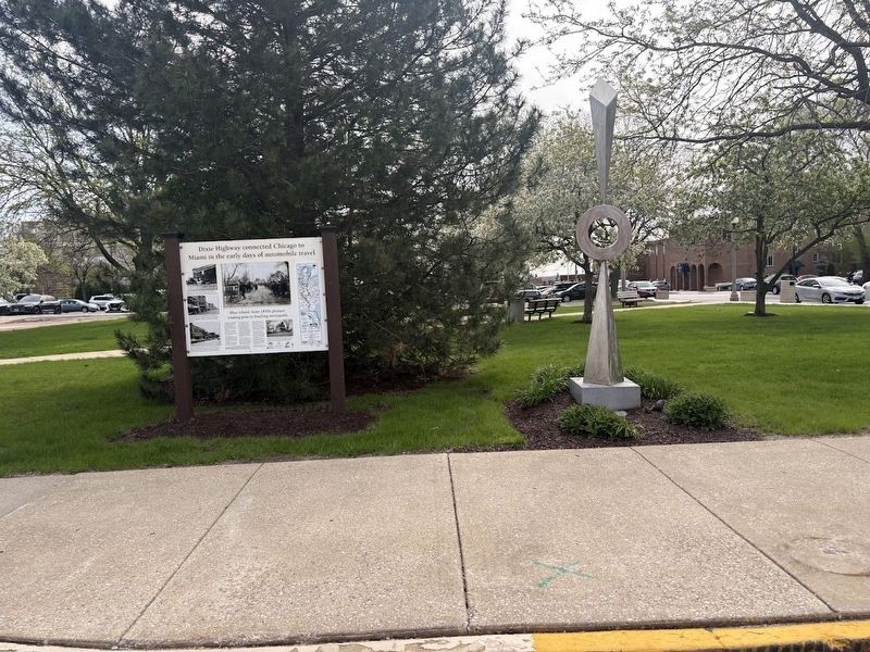
2. Dixie Highway sign in downtown Blue Island
From a dirt road to wooden planks
On the 1858 Volk map of Blue Island, the part of Western Avenue below the hill is called "Main, or Wabash Road," and the part of Western Avenue on top of the hill is "Blue Island Avenue," the most direct road from Blue Island to the west side of Chicago. There was also a wooden plank road constructed at $1800 per mile that charged a toll. Railroads were not looked upon favorably in the 1850s.
In March of 1893 the John V. McAdams Co. was awarded a contract to pave Western Avenue with cedar blocks at $1.14 per square foot for paving and 80 per lineal foot for curbing. In 1895, property owners paved Maple Avenue from Union to Vermont at their own expense.
In March of 1897 an ordinance was proposed to prohibit women from wearing "high and widely plumed hats," at shows and in other places of amusement, however, it died in the hands of the judiciary committee. In 1897 streetcars powered by batteries plied Western Avenue, an improvement on the old cable cars still in operation on some streets in Chicago. Trolley
Photographed by Sean P. Flynn, April 19, 2026
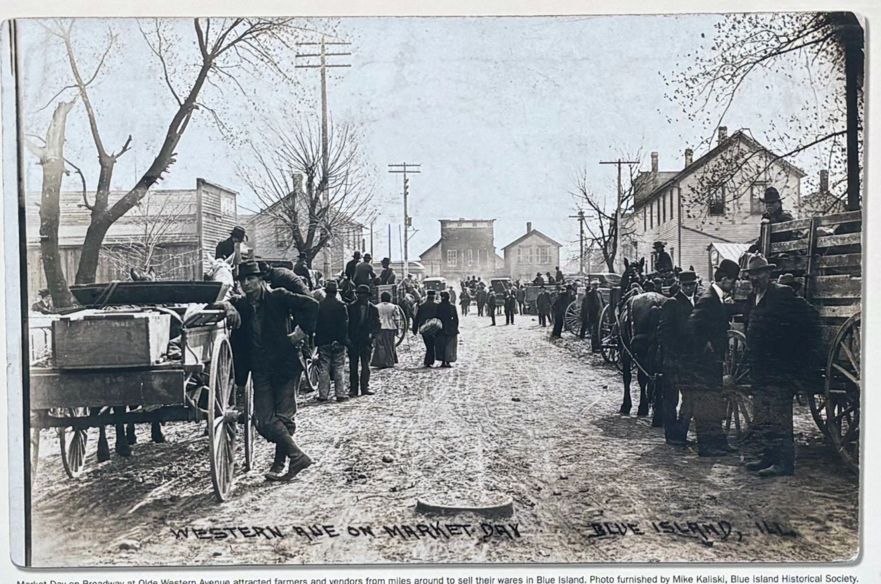
3. Close-up of the photo at the center of the marker
A highway to promote cross-country tourism
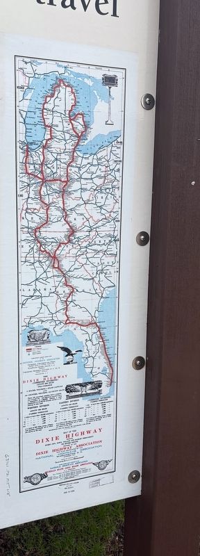
The Dixie Highway, an idea of Carl G. Fisher of the Lincoln Highway Association, was formed in 1915 to promote tourism by creating a north-south route of connected paved roads from Chicago to Miami so automobile enthusiasts from the urban north could vacation in the rural south. Dirt roads. were paved with brick or concrete to make them passable in any weather.
In Blue Island, Western Avenue served as the Dixie Highway, taking motorists through a bustling regional center of commerce and banking. Nationally-known retailers in Blue Island on the Dixie Highway included Sears, Wards and Piggly Wiggly. Local favorites were Kline's department store, Watland Cameras, Luchtemeyer Jewelers, Tots and Teens, Pronger Brothers Hardware, Schreiber Hardware and more.
Sources: Ice Age Lost, by Dr. Gwen Schultz: The First 100 Years, by John Volp; Geology Underfoot In Illinois, by Raymond Wiggers; drivingthedixie.org ©2014 Greg Lochow
This sign celebrates the 2015 centennial of the Dixie Highway and was made possible by the cooperative efforts of the A's R Us and Blue Island, Posen, Markham, Hazel Crest, Homewood, Flossmoor, Chicago Heights, Steger, Crete, Beecher, Grant Park and Momence.
[Caption
Photographed by Sean P. Flynn, April 19, 2026
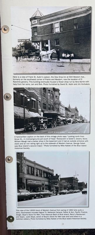
4. Three photos on the left side of the marker
Market Day on Broadway at Olde Western Avenue attracted farmers and vendors from miles around to sell their wares in Blue Island. Photo furnished by Mike Kaliski, Blue Island Historical Society.
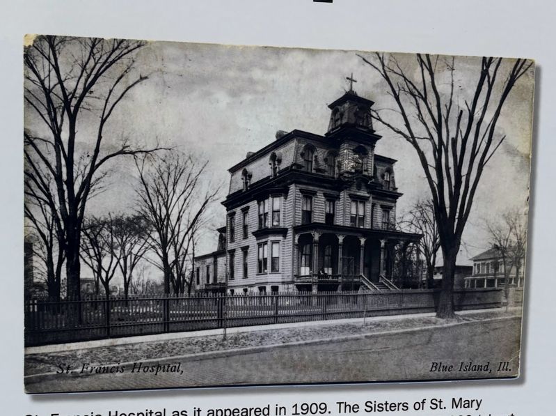
[Caption for photo to the right of the main text:]
St. Francis Hospital as it appeared in 1909. The Sisters of St. Mary purchased the home of the late Ernst Uhlrich in 1905 for $30,000 (about $766,000 in 2014), when this section of Gregory Street was lined with churches and the homes of Blue Island's more prosperous citizens.
[Captions for three photos on the left side:]
Here is a view of Frank St. Aubin's saloon, the Dew Drop Inn at 504 Western Ave., formerly on the southwest corner of Prairie and Western, now the location of El Ranchito grocery. This building eventually housed a flower shop run by Vera Bartle with help from her sons, Len and Bob. Photo furnished by David St. Aubin and Jim Korbakes.
A hand-written caption on the back of this vintage photo says "Looking north from Grove St., in mid background just south of Haas Restaurant is Gobet's Jewelry Store. William Waugh had a barber shop in the basement and it had an outside entrance with stairs and an iron railing right up to the sidewalk of Western Avenue. George Gobet was Blue Island's second mayor." Photo furnished by Mike Kaliski of the Blue Island Historical Society.
This view of the 13000 block of Western Avenue from spring of 1962 tells quite a story. Businesses included Signal TV, Watlande Camers, Father & Son, Pacific Finance, Singer, Boyd's Store For Men, First National Bank of Blue island, Reno's Restaurant and Sears. Justin Boyd, owner of Boyd's Store For Men was shot and killed in a botched robbery. Photo furnished by Mike Kaliski of the Blue Island Historical Society.
Erected 2015.
Topics and series.
Photographed by Sean P. Flynn, April 19, 2026
5. Photo of St. Francis Hospital to the right of the text on the marker
Location. 41° 39.446′ N, 87° 40.796′ W. Marker is on Blue Island, Illinois, in Cook County. It is on Western Avenue north of York Street, on the left when traveling south. Touch for map. Marker is at or near this postal address: 12975 Western Avenue, Blue Island IL 60406, United States of America. Touch for directions.

Regionally, this marker is in Greater Chicago and in the Calumet Region. It is also in the American Midwest. Globally, it is in North America, on the Great Lakes, in the Western Hemisphere, in the Western World, and in the Anglosphere. Historically, it finds itself in what was once the Viceroyalty of New France, the territory of the Mississippian Culture, and the Northwest Territory.
Other nearby markers. At least 8 other markers are within walking distance of this marker: The Joshua P. Young House (about 500 feet away, measured
Photographed by Sean P. Flynn, April 19, 2026
6. Dixie Highway map on the right side of the sign
More about this marker. At least two more signs with identical names can be found in Illinois, one in Homewood, another village in Cook County, and another in Momence, south of here in Kankakee County.
Also see . . . Dixie Highway Marks 100 Years. From the Chicago Southland website (Submitted on April 20, 2026, by Sean P. Flynn of Oak Park, Illinois.)
Credits. This page was last revised on April 20, 2026. It was originally submitted on April 20, 2026, by Sean P. Flynn of Oak Park, Illinois. This page has been viewed 37 times since then. Photos: 1, 2, 3, 4, 5, 6. submitted on April 20, 2026, by Sean P. Flynn of Oak Park, Illinois.
