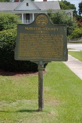
On McDuffie Avenue 0.2 miles west of Main Street (U.S. 78), on the left when traveling east.
McDuffie County was created by Act of Oct. 18, 1870 from Columbia and Warren Counties. It was named for George McDuffie (1788-1851). Born in Columbia (now Warren County, Ga.), he became a political leader in S.C. He was a Maj. Gen. of Militia, . . . — — Map (db m42688) HM
On East Liberty Street at South Jefferson Street, on the right when traveling east on East Liberty Street.
This library was Georgia’s first free (without a subscription fee) public library. Founded in 1888 by Dr. Francis T. Willis in memory of his daughter, it opened in 1889. Willis also created an endowment for the library and donated his personal . . . — — Map (db m23000) HM
On Waynesboro Highway (Georgia Route 24), on the left when traveling north.
This highway has been following closely the course of the Old Quaker Road, one of Georgia's earliest vehicular thoroughfares. It was opened about 1769 to link Savannah, the colonial capital, with a Quaker settlement centering around Wrightsboro in . . . — — Map (db m7992) HM
On South Liberty Street (State Highway 24) at U.S. 25, on the left when traveling west on South Liberty Street.
The highway bearing left is the Old Quaker road, on of Georgia's earliest vehicular highways. It was opened about 1769 to provide a direct way from Savannah to a Quaker settlement centering around Wrightsboro in today's upper McDuffie County. . . . — — Map (db m8022) HM
On North Main Street (U.S. 1) at Old Quaker Road, on the right when traveling south on North Main Street.
The highway crossing here is the Old Quaker Road, one of Georgia’s earliest vehicular thoroughfares. It was opened about 1769 to provide a direct way from Savannah, the Colonial capital, to a Quaker settlement centering around Wrightsboro in today’s . . . — — Map (db m15899) HM
On Main Street (Georgia Route 17) 0 miles north of McDuffie Avenue, on the left when traveling north.
Rear Admiral Richard E. Hawes has long been revered as a distinguished native son of Thomson-McDuffie County, Georgia. Admiral Hawes is remembered for his exceptionally heroic and meritorious service while performing his duty in the United States . . . — — Map (db m61010) HM
On Main Street (Georgia Route 17) at Railroad Street, on the right when traveling north on Main Street.
Willie Samuel McTear (1901-1959) was born between Big and Little Briar Creeks in the Happy Valley community. In 1911, he and his mother moved to Statesboro, where he began his life of traveling and performing. Although blind from infancy, Willie . . . — — Map (db m61012) HM
Thin black lines indicate changes in relevance. Between each pair of lines entries are ordered geographically but all have the same relevance.
* Inflectional forms of words are their plurals, singulars, and possessives as well as gramatical tenses and similar variations.