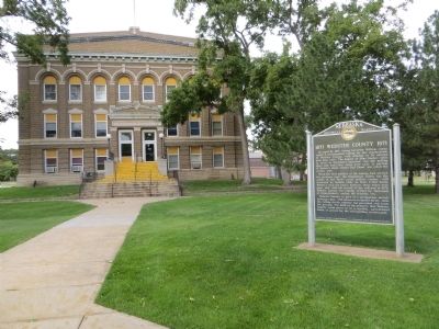
On West 6th Avenue west of North Cedar Street, on the right when traveling west.
On April 10, 1871, Acting Governor William James issued a proclamation calling for the organization of Webster County, with officials to be elected nine days later. The dugout of Silas Garber, later to serve as Nebraska's governor, was the polling . . . — — Map (db m77977) HM
On American Legion Memorial Highway (U.S. 281) 8.6 miles south of U.S. 20, on the right when traveling south.
Originally the entire responsibility for highways in Nebraska rested with the counties. In 1917 the Legislature accepted the provisions of a federal law and appropriated money to match federal funds for highway construction. This act marked the . . . — — Map (db m182016) HM
On North Webster Street at 3rd Avenue, on the left when traveling north on North Webster Street.
Red Cloud, named for the Oglala Sioux chief, was founded early in 1871 on homestead land filed upon by Silas Garber and company July 17, 1870, at Beatrice, the nearest land office. It is one of the oldest communities in the Republican Valley. When . . . — — Map (db m77975) HM
Willa Cather first came to Webster County from Virginia in 1883 at the age of nine. The vast open prairies of Nebraska made a lasting impression on her. "This country was mostly wild pasture and as naked as the back of your hand. I was little and . . . — — Map (db m77973) HM
On American Legion Memorial Highway (State Highway 4) just west of U.S. 281, on the left when traveling west.
Here on the Divide between the Republican and the Little Blue lived some of the most courageous people of the frontier. Their fortunes and their loves live again in the writings of Willa Cather, daughter of the plains and interpreter of man’s . . . — — Map (db m287674) HM
Thin black lines indicate changes in relevance. Between each pair of lines entries are ordered geographically but all have the same relevance.
* Inflectional forms of words are their plurals, singulars, and possessives as well as gramatical tenses and similar variations.