3 entries match your criteria.
Related Historical Markers
To better understand the relationship, study each marker in the order shown.
By Bradley Owen, October 18, 2023
Battle of Cross Keys Marker
SHOWN IN SOURCE-SPECIFIED ORDER
| Near Port Republic Road (Route 659), on the right when traveling south. |
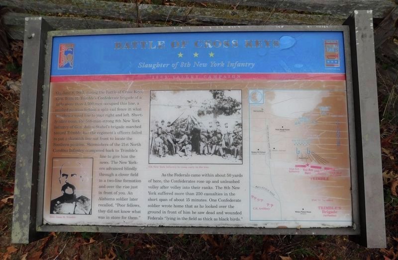
| | On June 8, 1862, during the Battle of Cross Keys, Gen. Isaac R. Trimble’s Confederate brigade of a little more than 1,500 men occupied this line, a masked position behind a split-rail fence in what was then a wood line to your right and left. . . . — — Map (db m159602) HM |
| On Port Republic Road (County Route 659) south of Cross Keys Road (Virginia Route 276), on the right when traveling south. Reported missing. |
| | During the Civil War, this battlefield contained some of the most productive
farmland in the Shenandoah Valley and Virginia, as it does today. At
the time of the battle, these fields were in stands of wheat, buckwheat, rye,
corn, and clover. . . . — — Map (db m25551) HM |
| On Port Republic Road (County Route 659) south of Cross Keys Road (Virginia Route 276), on the right when traveling south. Reported missing. |
| | Confederate Gen. Richard S. Ewell had five artillery batteries with him at Cross Keys. Four batteries and a 2-gun section (about 18 guns total) were massed on the ridgeline to your front. At the time of the battle on June 8, 1862, the ridge was . . . — — Map (db m25550) HM |
Jun. 15, 2024