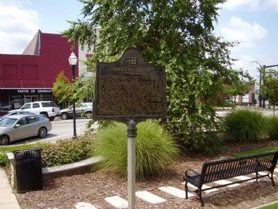
On East Howell Street (U.S. 29) east of Carolina Street, on the left when traveling east.
Hart County was created by the Legislature on Dec. 7, 1853 out of portions of Franklin and Elbert counties. It is the only county in Georgia named for a woman - Nancy Hart.
Nancy Hart and her husband, Benjamin Hart, obtained a 400 acre grant . . . — — Map (db m21343) HM
Near Capitol Avenue Southwest north of Capital Square Southwest, on the right when traveling north.
Georgia’s most acclaimed female participant during the Revolutionary War was Nancy Morgan Hart. A devout patriot, Hart gained notoriety during the Revolution for her determined efforts to rid the area of Tories, English soldiers, and British . . . — — Map (db m215340) HM
On North Richardson Street north of Colfax Street, on the right when traveling north.
Hart County Training School (HCTS), established in 1924 for the education of African-American children, was partially funded by the Rosenwald School Building Program. This
program matched funds from philanthropist Julius Rosenwald with community . . . — — Map (db m239143) HM
On Shoal Creek Church Road (County Route 245) 0 miles south of Bill Lucas Road, on the right when traveling north. Reported missing.
Parkertown was founded in 1832 in what was then Franklin County, now Hart County, by Joseph A. Parker who was born in Virginia in 1774 and moved to Elbert County, Ga. in 1796. He later moved to Big Shoal Creek where Jacob Parker & Co. founded by his . . . — — Map (db m45081) HM
On West Franklin Street (State Highway 77) at North Forest Avenue, on the left when traveling west on West Franklin Street.
Center
The Broken V Symbolizes the Casualties, Broken Dreams, Promises and Plans.
Dedicated November 15, 1987 by Hart County Citizens to Honor The memory of the Six Hart County Men whose patronage never dimmed:
Whose Loyalty never . . . — — Map (db m239151) WM
Near Baxter Avenue (U.S. 31E/150) at Cherokee Road, on the right when traveling north.
Civil War Louisville
When the Civil War began, Louisville was the largest city in Kentucky and the twelfth largest in the nation. Because its commercial and industrial economy was not dependent on slave labor, less than 10 percent of the . . . — — Map (db m161213) HM
Thin black lines indicate changes in relevance. Between each pair of lines entries are ordered geographically but all have the same relevance.
* Inflectional forms of words are their plurals, singulars, and possessives as well as gramatical tenses and similar variations.