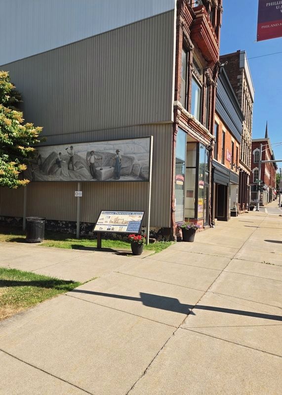
On North Main Street (New York State Route 98) north of East Bank Street, on the right when traveling north.
Architectural Features
The Pratt building, at right, includes a third floor opera house. This site was built in 1882 and was the largest stage between Buffalo and Rochester.
The Village Hall and firehouse on East Bank Street is an ornate . . . — — Map (db m179738) HM
On Main Street (New York State Route 63) 0.1 miles north of West Center Street ( Route 31E), on the right when traveling south.
[south side] Frederick Douglass abolitionist and statesman spoke in the Methodist Episcopal church that stood at this place, April 3, 1849 during an extended visit to Orleans County. [north side] Frederick Douglass delivered a renowned . . . — — Map (db m83143) HM
On Ridge Road West (New York State Route 104) 0.1 miles east of Gaines Waterport Road ( Route 279), on the right when traveling west.
"I sing of the great Ridge Road, Of the highway our children shall see That lies like a belt on Ontario's shore Carved out in wisdom of ages before For the races that yet are to be." TREK—DE WITT CLINTON—1810 "In the great work . . . — — Map (db m78216) HM
On State Street north of East Center Street ( Route 31), on the left when traveling north.
Silas Mainville Burroughs, Sr. (1810-1860)
Silas Burroughs made many important contributions to the Village of Medina and owned considerable land here, farming, running a lumber business and legal practice.
Burroughs served as . . . — — Map (db m276975) HM
Near Telegraph Road (New York State Route 31) 0.3 miles east of Butts Road, on the right when traveling east.
Before he became Santa, Charles Howard was a farmer on the west side of Albion. He was an active member of the community and a pillar of the United Methodist Church. He loved to participate in the Orleans County Fair, and helped the community set . . . — — Map (db m306493) HM
On South Main Street (New York State Route 98) at West Park Street on South Main Street.
1941 1945
In sacred memory of our soldiers and sailors who made the supreme sacrifice
Orleans County
State of New York
"Greater love than this no one has, that one lay down his life for his friends." John XV-13
May they rest in peace
Dedicated . . . — — Map (db m65379) WM
On Knowlesville Road (County Route 4) at Portage Road, on the right when traveling north on Knowlesville Road.
[east side] Welcome to the Canalway Trail System, offering hundreds of miles of scenic trails and numerous parks for walking, bicycling, cross country skiing and other recreational activities. The Canalway Trail parallels the New York State Canal . . . — — Map (db m82030) HM
On North Platt Street 0.1 miles north of East Bank Street, on the right when traveling north.
Breadbasket of the United States: The Erie Canal opened up the world to our region’s farmers. Agricultural products and raw materials were distributed to distant locations, beyond the reach of horse and buggy. Lower costs and decreased . . . — — Map (db m206656) HM
On Holley Byron Road (New York State Route 237) at Glidden Road, on the right when traveling south on Holley Byron Road.
Buried here are those whose labor, energy, spirit and love
once lived in Clarendon. May they not be forgotten.
Notable Burials:
Chauncey Robinson (1792-1866): Veteran, War of 1812; Abolitionist
William Lewis (1787-1826): First Sheriff of . . . — — Map (db m169943) HM
The upriver ports of Carthage and Kelsey's Landing were stopping places for boats bound for Canada. Escaped slaves arrived in Rochester via the "Underground Railroad" and looked for a friendly captain to take them across the lake and deliver them . . . — — Map (db m90608) HM
On Main Street (New York State Route 63) north of West Center Street, on the left when traveling north.
The Main Street Historic District in Medina, New York, United States, is the downtown commercial core of the village It is a 12-acre area stretching south along Main Street from the Erie Canal to the railroad tracks. Its buildings contribute to . . . — — Map (db m277256) HM
On Main Street (New York State Route 146) at Gun Club Road, on the right when traveling west on Main Street.
Welcome to Altamont
The Village of Altamont and its immediate surroundings were once part of a tract of land deeded in 1630 by the Dutch West India Company to Killian Van Rensselaer (c. 1586-1643),a wealthy 17th century Dutch . . . — — Map (db m283534) HM
On Park Street at Main Street, on the right when traveling south on Park Street.
Welcome to Altamont
The Village of Altamont and its immediate surroundings were once part of a tract of land deeded in 1630 by the Dutch West India Company to Killian Van Rensselaer (c. 1586-1643),a wealthy 17th century Dutch . . . — — Map (db m308938) HM
Thin black lines indicate changes in relevance. Between each pair of lines entries are ordered geographically but all have the same relevance.
* Inflectional forms of words are their plurals, singulars, and possessives as well as gramatical tenses and similar variations.