2 entries match your criteria.
Related Historical Markers
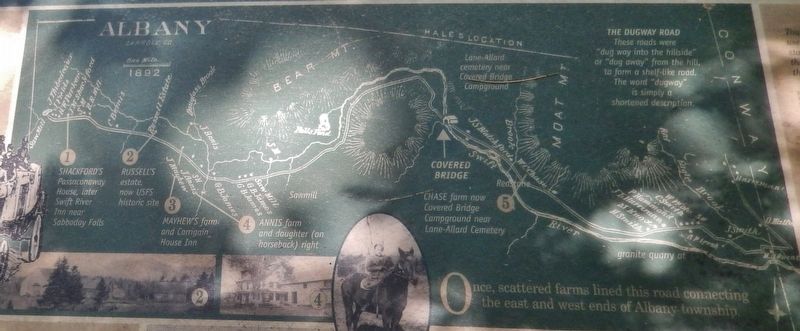
By Cosmos Mariner, July 5, 2017
Marker detail: Albany map
SHOWN IN SOURCE-SPECIFIED ORDER
1 ► New Hampshire, Carroll County, Albany — Cart Roads and Wagon Paths Connect a Community —  |
| On Passaconaway Road east of Kancamagus Highway (New Hampshire Route 112), on the right when traveling east. | |||
| 2 ► New Hampshire, Carroll County, Albany — How the Covered Bridge was Built — |
| Near Passaconaway Road east of Kancamagus Highway (New Hampshire Route 112) when traveling east. | |||