Marker Logo HMdb.org THE HISTORICAL
MARKER DATABASE
“Bite-Size Bits of Local, National, and Global History”


3 entries match your criteria.  


Related Historical Markers

To better understand the relationship, study each marker in the order shown.
 
State Line Marker image, Touch for more information
By Dale K. Benington, July 16, 2009
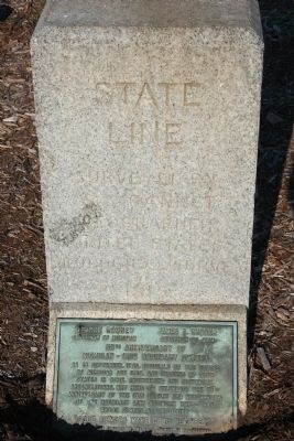
State Line Marker
SHOWN IN SOURCE-SPECIFIED ORDER
1 Michigan, Monroe County, Lost Peninsula — State Line50th Anniversary of Michigan - Ohio Boundary Survey
On Edgewater Drive at Lost Peninsula Marina Drive, on the right when traveling north on Edgewater Drive.
2 Michigan, Monroe County, Erie — "War" With Happy Ending
On South Dixie Highway, 0.1 miles north of East Temperance Road, on the right when traveling south.
3 Ohio, Fulton County, Seward — 2-26 — The Ohio Michigan Boundary War / Battle of Phillips CornersOhio Historical Markers
On Ohio Route 109 at Ohio Route 120, on the left when traveling north on State Route 109.


CeraNet Cloud Computing sponsors the Historical Marker Database.
This website earns income from purchases you make after using our links to Amazon.com. We appreciate your support.
Paid Advertisement
Jun. 2, 2024