13 entries match your criteria.
Related Historical Markers
Markers related to J.E.B. Stuart's Ride around McClellan
By Craig Swain, May 26, 2012
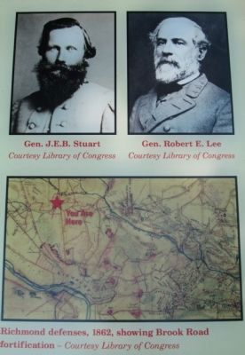
Portraits and Map
SHOWN IN SOURCE-SPECIFIED ORDER
| Near Brook Road (U.S. 1) 0.1 miles west of Brook Road, on the right when traveling south. Reported missing. |
| On Elmont Road (County Route 626) 0.2 miles north of Cobbs Road, on the right when traveling north. |
| On Cedar Lane (County Route 623) at Ashland Road, on the left when traveling west on Cedar Lane. |
| On Blanton Road (County Route 666) at West Patrick Henry Road (Virginia Highway 54), on the right when traveling north on Blanton Road. |
| On Cedar Lane (County Route 623) at Winns Church Road, on the left when traveling west on Cedar Lane. |
| On North Washington Highway (U.S. 1) 0.6 miles north of Jamestown Road, on the right when traveling north. |
| On Hanover Courthouse Road (U.S. 301) 0.2 miles north of Depot Road, on the right when traveling north. Reported permanently removed. |
| On New Kent Highway at Old Church Road, on the right when traveling east on New Kent Highway. |
| On Studley Road, 0.3 miles south of Locust Green Lane, on the right when traveling east. |
| On Studley Road at Southard Lane, on the right when traveling south on Studley Road. |
| On Mechanicsville Turnpike (U.S. 360) at Studley Road, on the left when traveling east on Mechanicsville Turnpike. |
| On New Kent Highway at Old Church Road, on the right when traveling east on New Kent Highway. |
| On Pocahontas Trail (U.S. 60) 0.1 miles east of Olivet Church Road, on the right when traveling east. |
Jun. 1, 2024