4 entries match your criteria.
Related Historical Markers
This marker has additional photographs of the wreck.
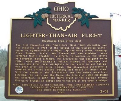
By William Fischer, Jr., December 23, 2008
Lighter-Than-Air Flight Marker
SHOWN IN SOURCE-SPECIFIED ORDER
| On Marietta Road (Ohio Route 821) at Rayner Road, on the right when traveling south on Marietta Road. |
| On Marietta Road (Ohio Route 821) 0.5 miles north of Rayner Road, on the right when traveling north. |
| On Shenandoah Road (County Route 112), on the right. |
| On McConnelsville Road (Ohio Route 78), on the right when traveling west. |
Nov. 11, 2026
