4 entries match your criteria.
Related Historical Markers
"Territorial Road", "Under the Oaks", "Jacksonburgh Public Square", "First State Prison"
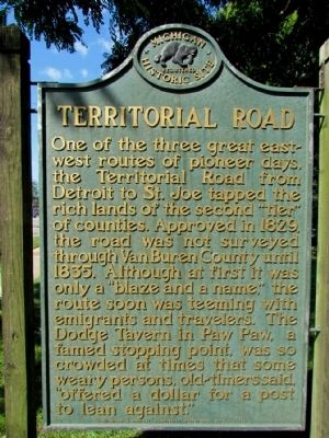
By Duane Hall, September 4, 2013
Territorial Road Marker
SHOWN IN SOURCE-SPECIFIED ORDER
| On W. Michigan Avenue 0.1 miles west of Gremps Street, on the right when traveling west. |
| On West Franklin Street at Second Street, on the right when traveling west on West Franklin Street. |
| On North Jackson Street at West Michigan Avenue, on the right when traveling north on North Jackson Street. |
| On North Mechanic Street north of Armory Court, on the left when traveling north. |
Nov. 11, 2026
