2 entries match your criteria.
Related Historical Markers
Old Markers At This Location: "A Thunderous Charge" was relocated after replacing and an earlier version titled "A Violent Collision of Cavalry".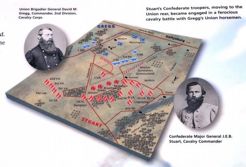
By Karl Stelly, January 25, 2021
Map of the Battle
SHOWN IN SOURCE-SPECIFIED ORDER
1 ► Pennsylvania, Adams County, Gettysburg, Mount Pleasant Township — A Thunderous Charge — Jul 3, 1:00-3:00 pm — Gettysburg National Military Park —  |
| On Confederate Cavalry Avenue 0.4 miles east of Hoffman Road, on the right when traveling south. | |||
| 2 ► Pennsylvania, Adams County, Gettysburg, Mount Pleasant Township — A Violent Collision of Cavalry — July 3, 1863 - Third Day |
| On Gregg Avenue (Cavalry Field Road), on the right when traveling east. Reported missing. | |||