4 entries match your criteria.
Related Historical Markers
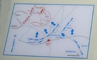
By Bill Coughlin, April 26, 2007
Detail of the Battle map of the Battle of Appomattox Station
SHOWN IN SOURCE-SPECIFIED ORDER
1 ► Virginia, Appomattox County, Appomattox — Battle of Appomattox Station — Final Blow — Lee's Retreat —  |
| On Main Street (Virginia Route 131), on the right. | |||
| 2 ► Virginia, Appomattox County, Appomattox — K-159 — Battle of Appomattox Station — 1865 — |
| On Main Street (Virginia Route 131) at Church Street, on the right when traveling east on Main Street. | |||
| 3 ► Virginia, Appomattox County, Appomattox — Battle of Appomattox Station — Lee's Retreat — |
| On Main Street, on the right when traveling east. | |||
| 4 ► Virginia, Appomattox County, Appomattox — Battle of Appomattox Station — April 8, 1865: 4-8 p.m. — |
| On State Highway 24, on the right when traveling east. | |||